Work samples
-
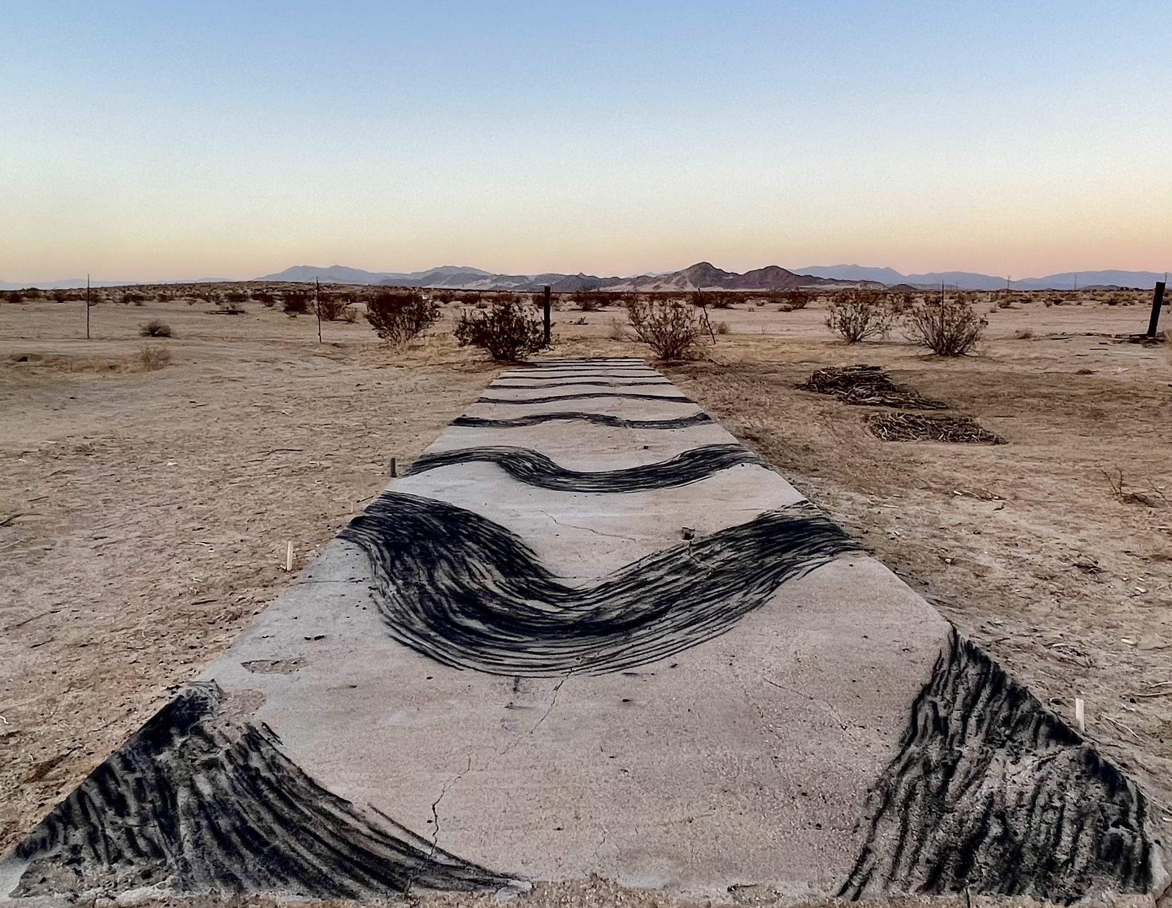
 Jet Stream Slab Charcoal Drawing
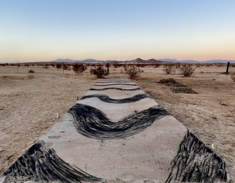
View of charcoal drawing on concrete slab of changing Arctic jet stream patterns. With collected sticks from the property, I would make charcoal in an earth oven and draw onto an old concrete slab on the Desert Dairy Residency property in California. These patterns I was recording are the changes in the Arctic Jet streams that are creating stalled dry seasons and extreme weather events across the United States.
-
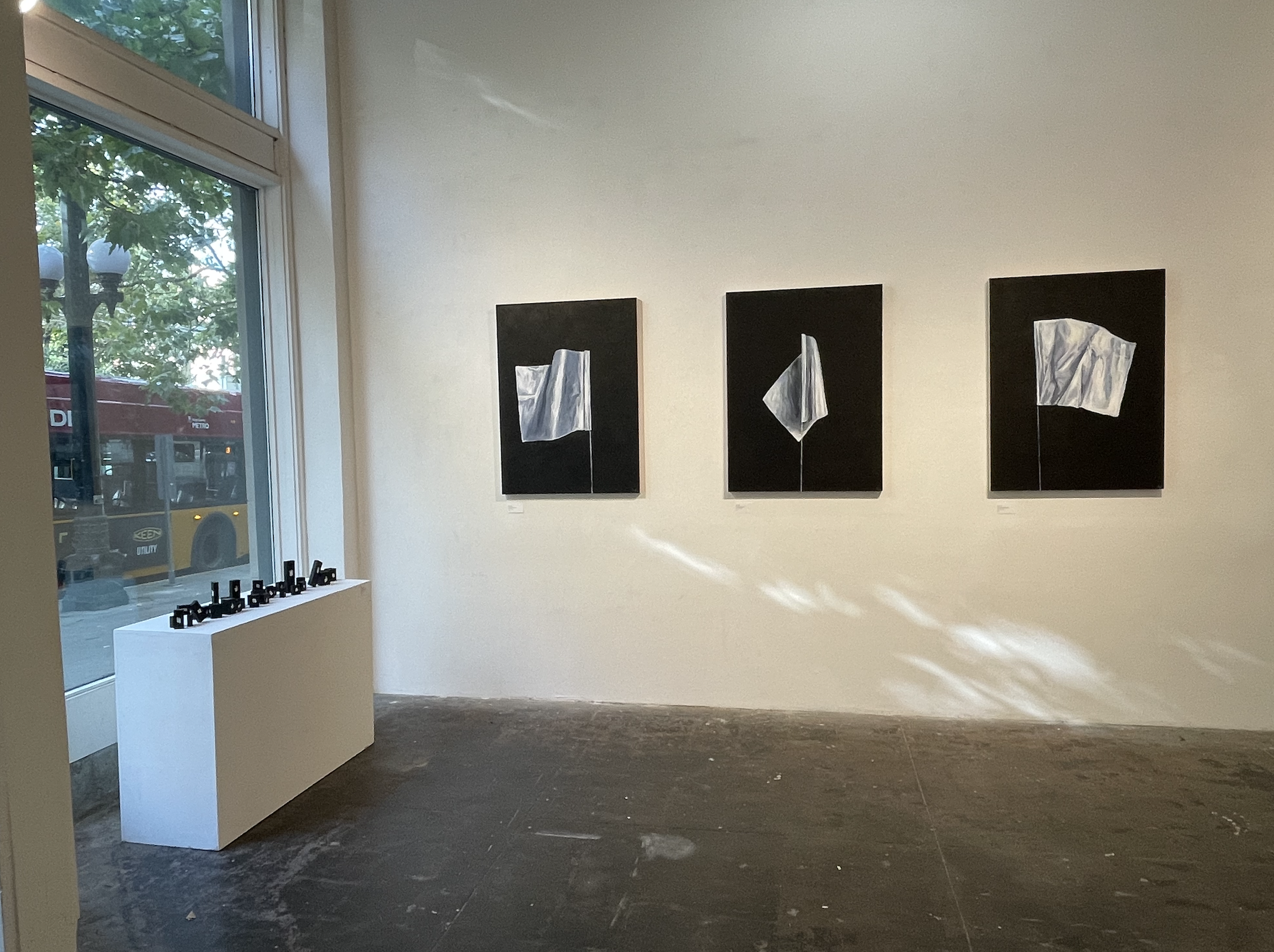
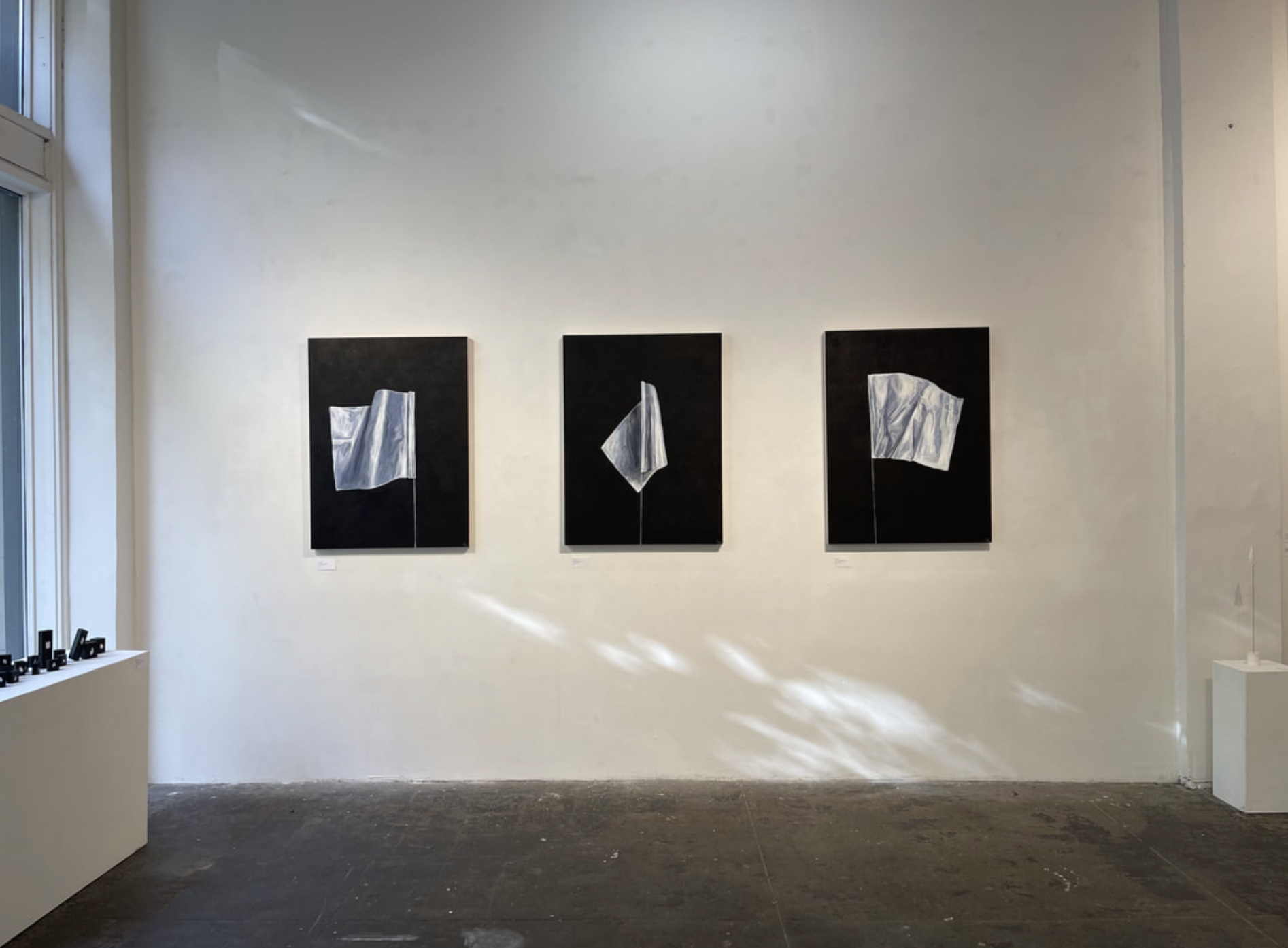
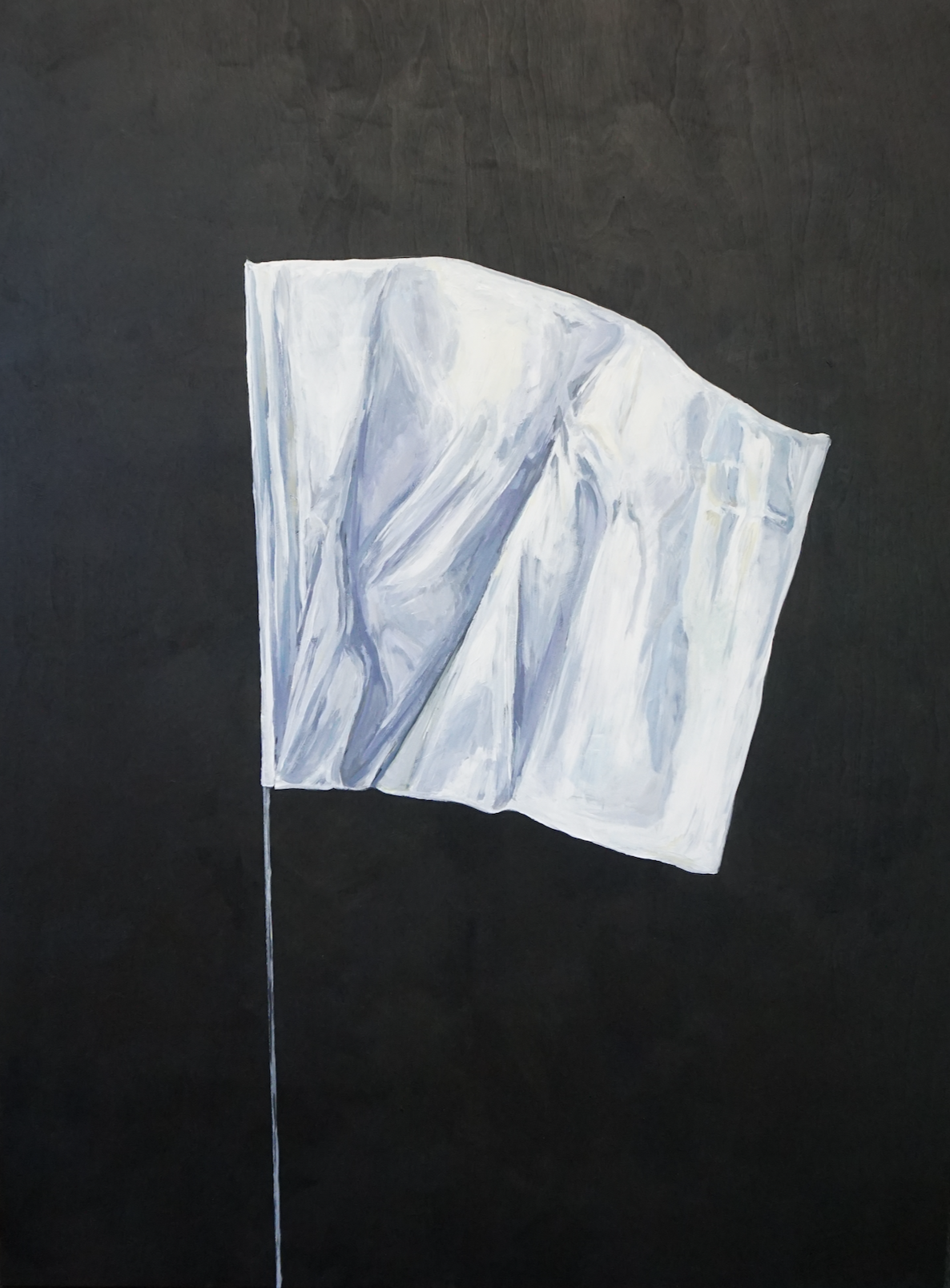
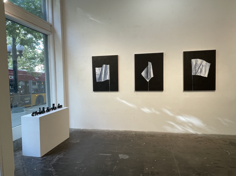 Gallery View Arctic Pending White Flags
Gallery View of three white flag paintings from the Arctic Pending series. They comment on the titanium flag placed at the bottom of the North Pole in the Arctic circle by Russian submarines and the way we use flags to symbolize surrender, boundary marking, and land ownership. Beside these paintings in the gallery are smaller white flags painted on blocks of wood similar to children's toy blocks.
-
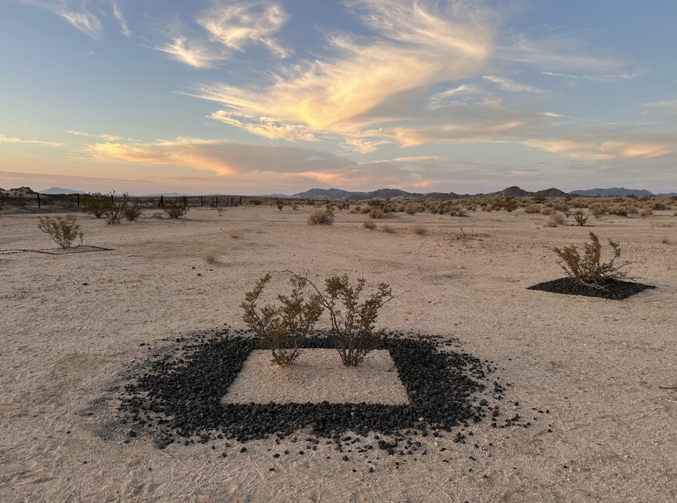
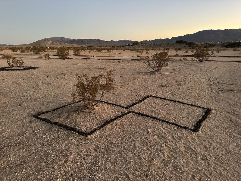
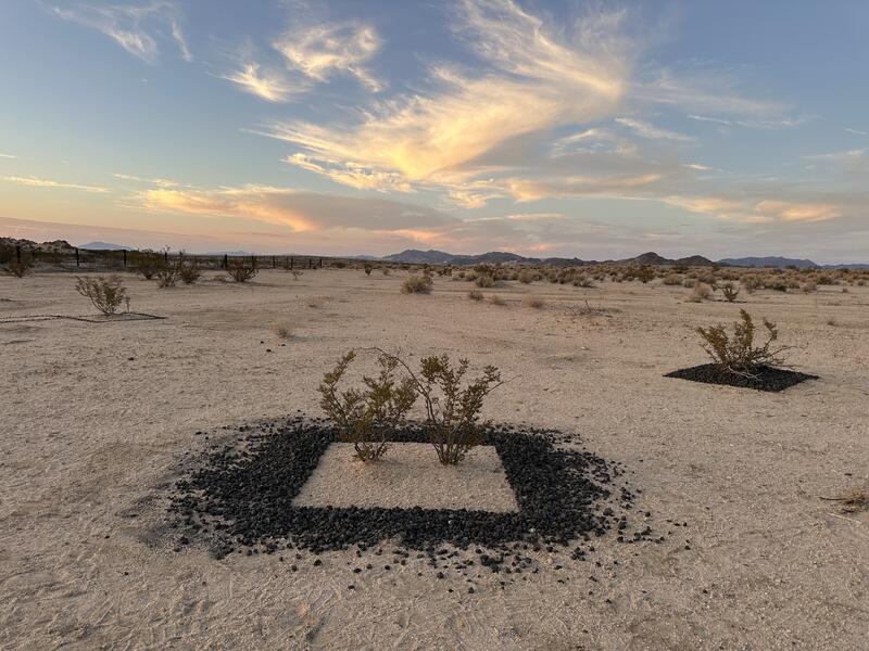
 Square Meter: Basalt Creosotes
Creosote plants dot the horizon of the desert and can capture carbon out of the atmosphere and store it underground with roots sometimes as deep as 40 feet below the sandy surface. For every gallon of oil burned, a square meter of mature forest is needed to counterbalance that carbon released. Basalt rock is often used to geo-engineer carbon sequestration. Using natural basalt rock, I placed square meters around various creosote plants in California.
-
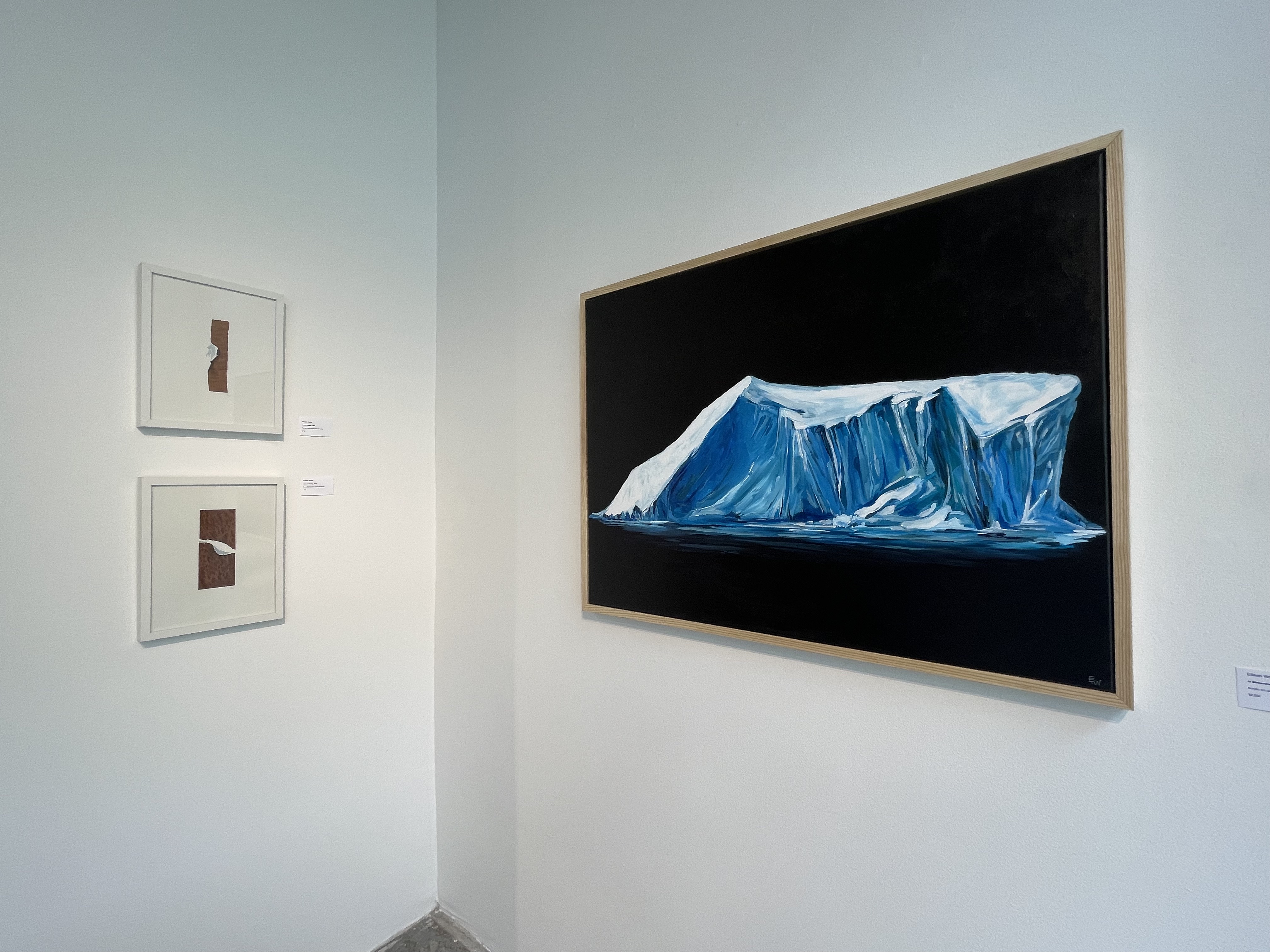
 In Memoriam
This gallery view of works from the Arctic Amplification exhibition shows the painting "In Memoriam" and two small collage works that illustrate stalled weather systems. In Memoriam depicts a single glacier against a black background as a memorial to the melting ice that we are loosing each day. A simple exploration of beauty, sadness, grandeur and loss.

About Eileen

Eileen Wold received her MFA from the Maryland Institute College of Art and her BA in Studio Art from Loyola University Maryland. She studied painting at the Art Academy of Leuven, Belgium and has taught studio art and critical theory courses for over 10 years. Wold was born and raised in New York, has lived in Seattle, Barcelona, DC and currently resides in Maryland.
Wold has exhibited and lectured at galleries, universities and museums across the country and was featured on PBS… more
Arctic Pending
-
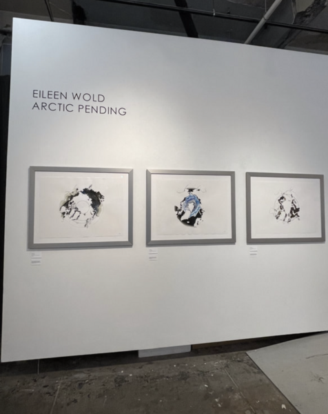 Arctic Pending Maps
Five watercolor maps of the arctic circle explore the natural gas and oil reserves, ice melt, permafrost loss, political boundaries and temperature changes in the region.
-
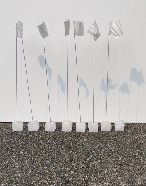
 Arctic Pending Flags
How we define boundaries between countries and regions is determined by man. But the geological forces that we have changed due to releasing carbon do not recognize these flags in the ground.
-
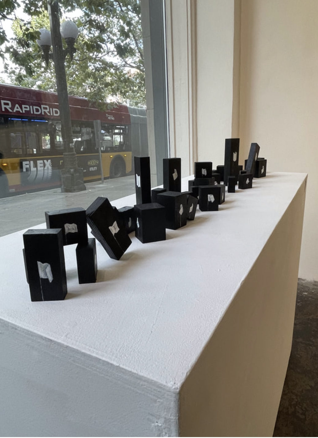
 Arctic Pending Line
How we define boundaries between countries and regions is determined by man. But the geological forces that we have changed due to releasing carbon do not recognize these flags in the ground. These small flag paintings resemble children's playing blocks that can be moved and reshaped.
-
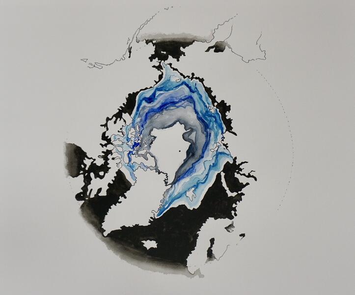 Arctic Pending Map: Glacial Fragility
Watercolor of Arctic Circle Ice melt over 20 year time period
-
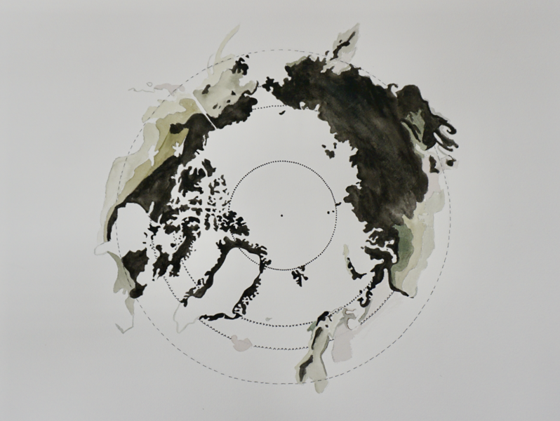 Arctic Pending Map: Permamelt
Watercolor Map of Arctic Circle permafrost melt over 20 year period.
-
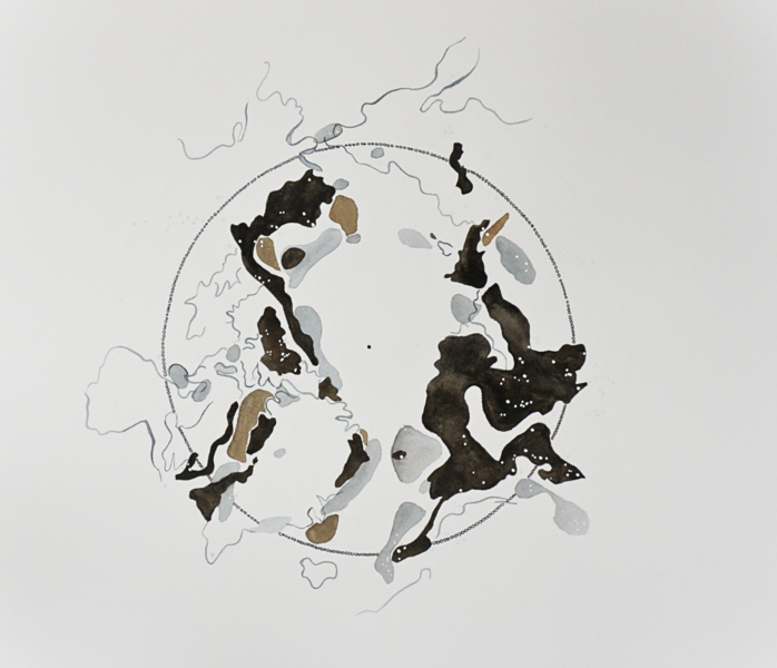 Arctic Pending Map: Frozen Commodities
Watercolor map of Arctic Circle oil, coal and gas current and projected reserves as well as silver dots to identify current and planned mines for extraction and refinement of natural resources.
-
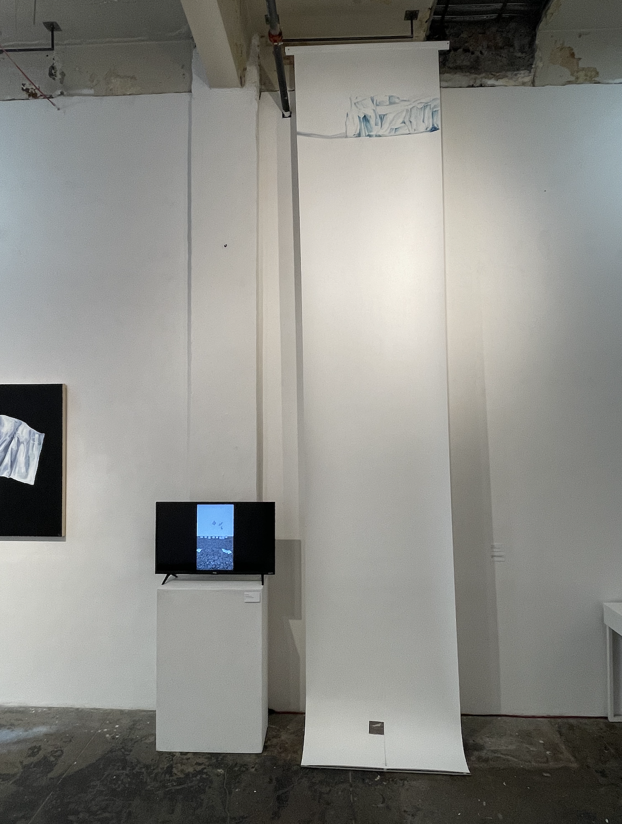
 Installation Shot of Under The Ice and Video: Melting Boundaries
Installation Shot of Under The Ice, a watercolor drawing of a glacier on a scroll that ends with a white flag cast in plaster and a titanium shadow. This work explores the titanium flag placed on the seabed floor of the North Pole at the center of the Arctic Circle by a Russian submarine craft to claim ownership of the region when the ice melts.
Installation shot of Video: Melting Boundaries, a five minute video that loops showing eight flags cast in ice. There are eight countries that control ice, land and water in the Arctic Circle. The flags fall as the ice melts.
-
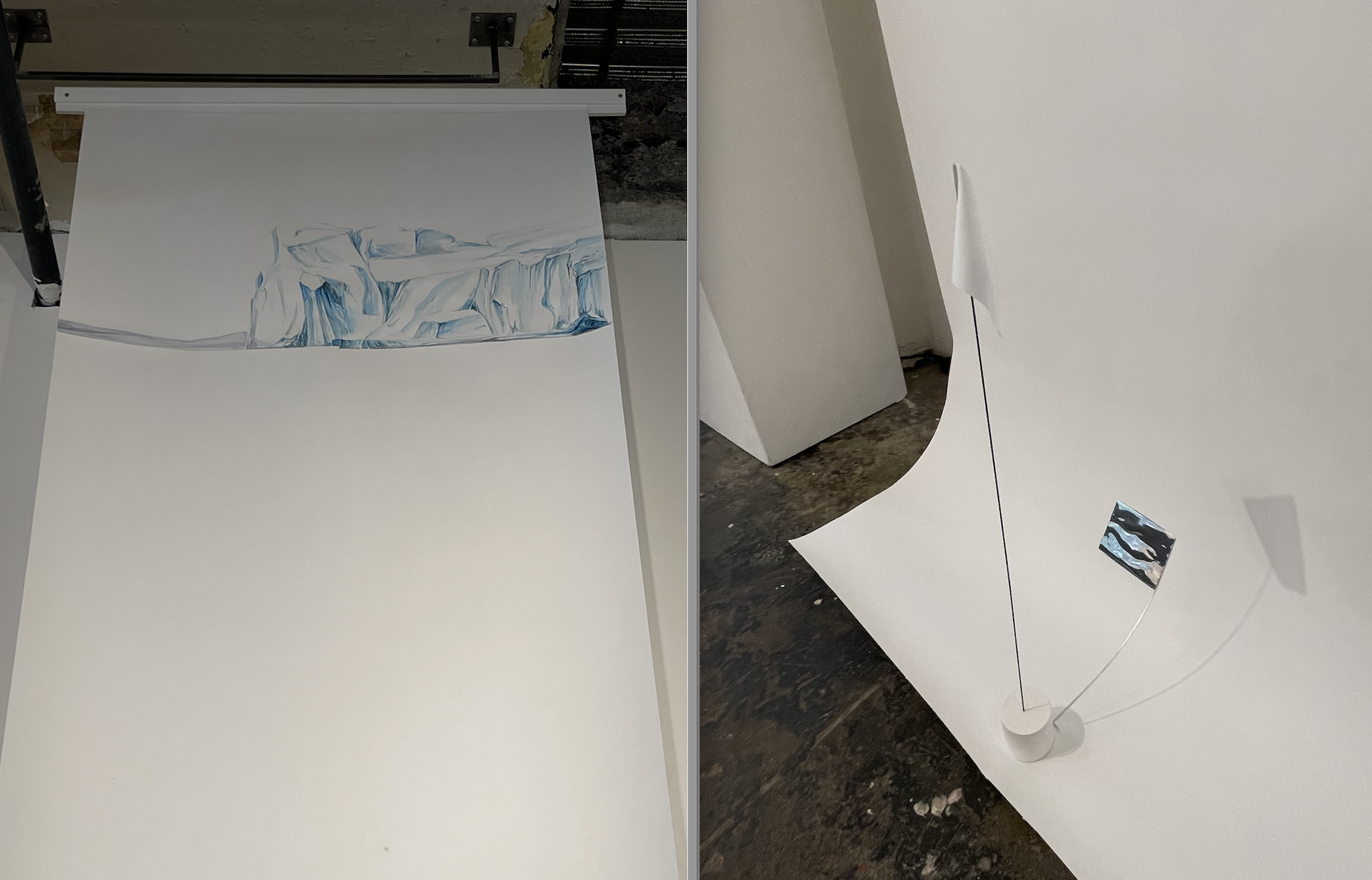
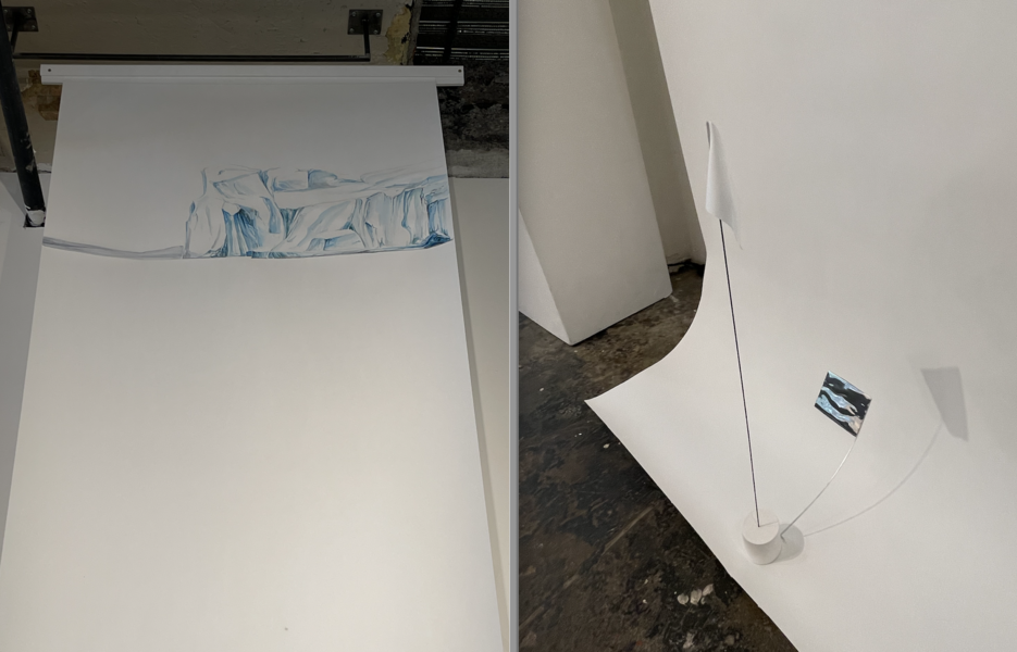 Detail: Under The Ice
Installation Shot of Under The Ice, a watercolor drawing of a glacier on a scroll that ends with a white flag cast in plaster and a titanium shadow. This work explores the titanium flag placed on the seabed floor of the North Pole at the center of the Arctic Circle by a Russian submarine craft to claim ownership of the region when the ice melts.
-
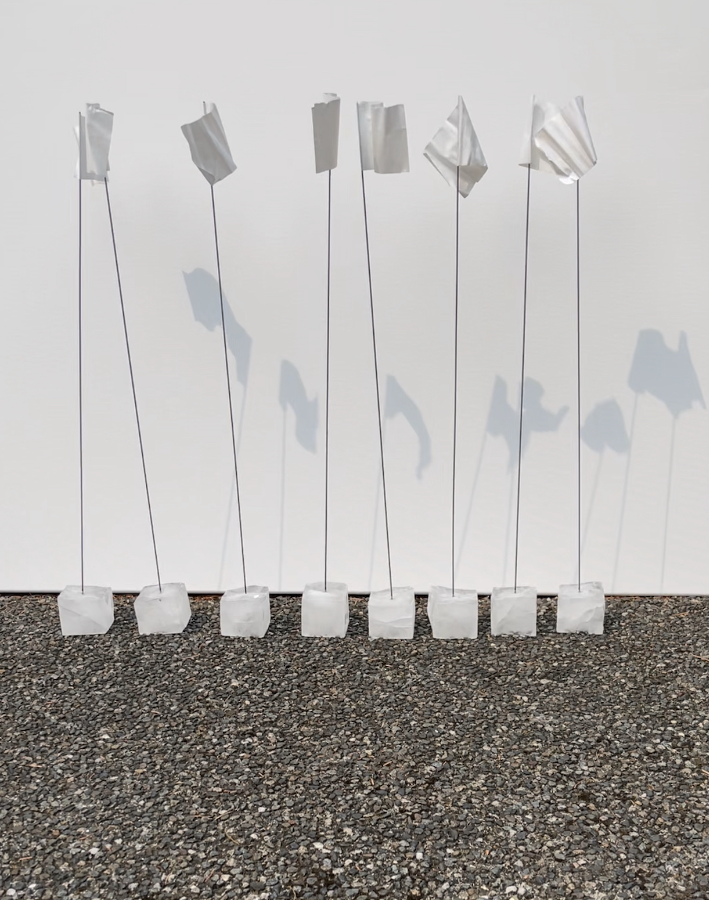
 Still of video: Melting Boundaries
Installation shot of Video: Melting Boundaries, a five minute video that loops showing eight flags cast in ice. There are eight countries that control ice, land and water in the Arctic Circle. The flags fall as the ice melts.
-
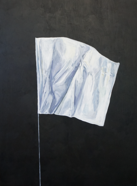 Arctic Surrender
This series of flag paintings referenced the flag at the bottom of the North Pole placed by a Russian submarine as well as the flags humans use to lay claim to land they want to occupy. We also use white flags as a device to signal surrender and a white lawn flag that this is fashioned from is used to mark boundary movement in excavation.


Square Meter
-
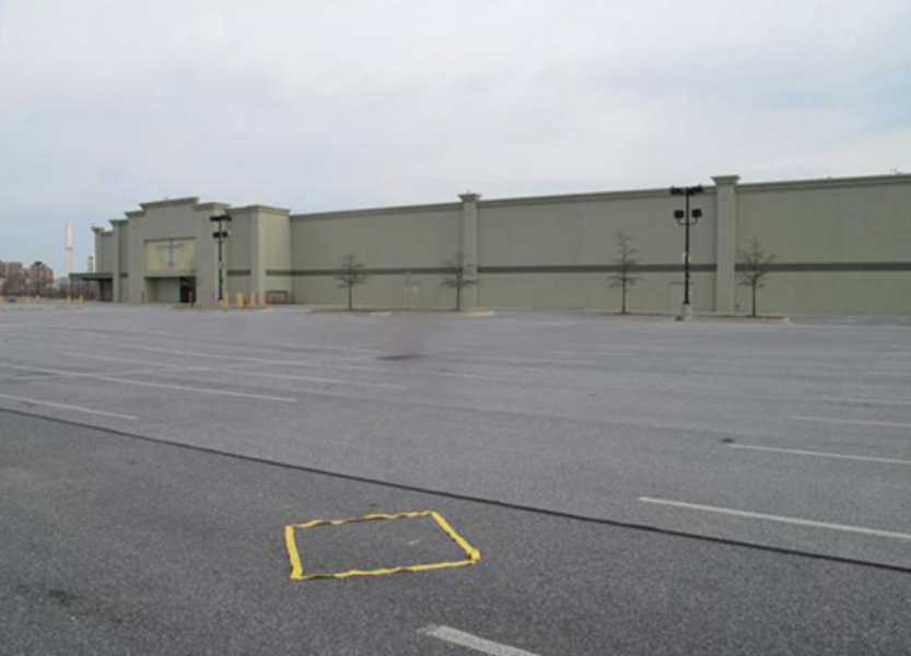
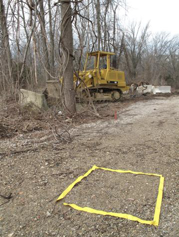
 Square Meter: Deforest
We know that a square meter of mature forest is needed to act as a carbon sink for each gallon of oil we burn. This photo of the yellow tape square meter also comments on the rate at which humans are deforesting the planet.
-
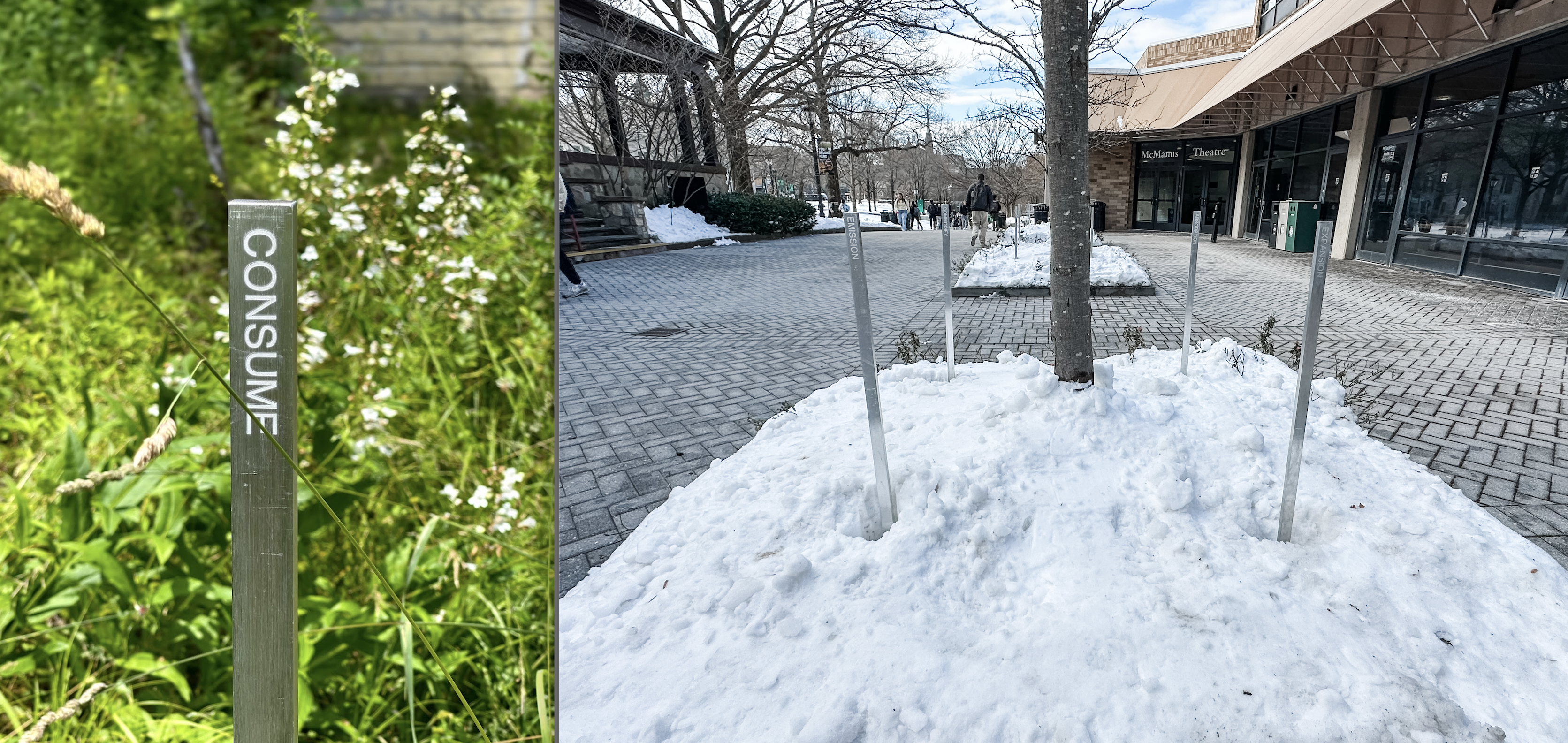
 Square Meter Aluminum Posts
These square meters are marked by recycled aluminum posts that are inscribed with words on each side that illustrate the balance of our natural systems and human actions that are changing them. The posts make square meters in the forest, around trees, and on paths that a human can stand inside of to understand the volume of a square meter.
-
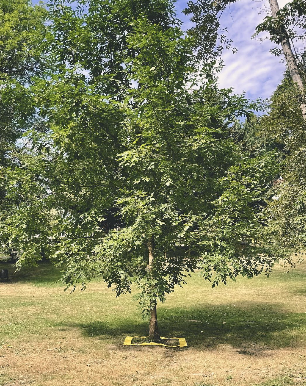
 Square Meter Oregon Ash Tree
This square meter is placed around an Oregon Ash tree at the Verdancy Residency outside of Portland. The native tree stands alone in the landscape and the square meter reminds us that a single tree can act as a the carbon sink for each gallon of oil burned.
-
 Square Meter Absence and Presence
This documentation of the square meter shows both the presence of a carbon sequestering plant in the landscape and the absence of one.
-
 Square Meter: Parking Lot
If we are looking at the world in terms of carbon release and absorption, seeing paved areas meant for cars, reminds us of the square meters of space designated for carbon release in our culture.
-
 Basalt Square Meter
Creosote plants dot the horizon of the desert and can capture carbon out of the atmosphere and store it underground with roots sometimes as deep as 40 feet below the sandy surface. For every gallon of oil burned, a square meter of mature forest is needed to counterbalance that carbon released. Basalt rocks are being crushed and used to absorb carbon out of the atmosphere as it is a mineral that naturally does so. This geo-engineering is just one of many ways humans are attempting to understand and manipulate the carbon cycle to cool the warming planet.
-
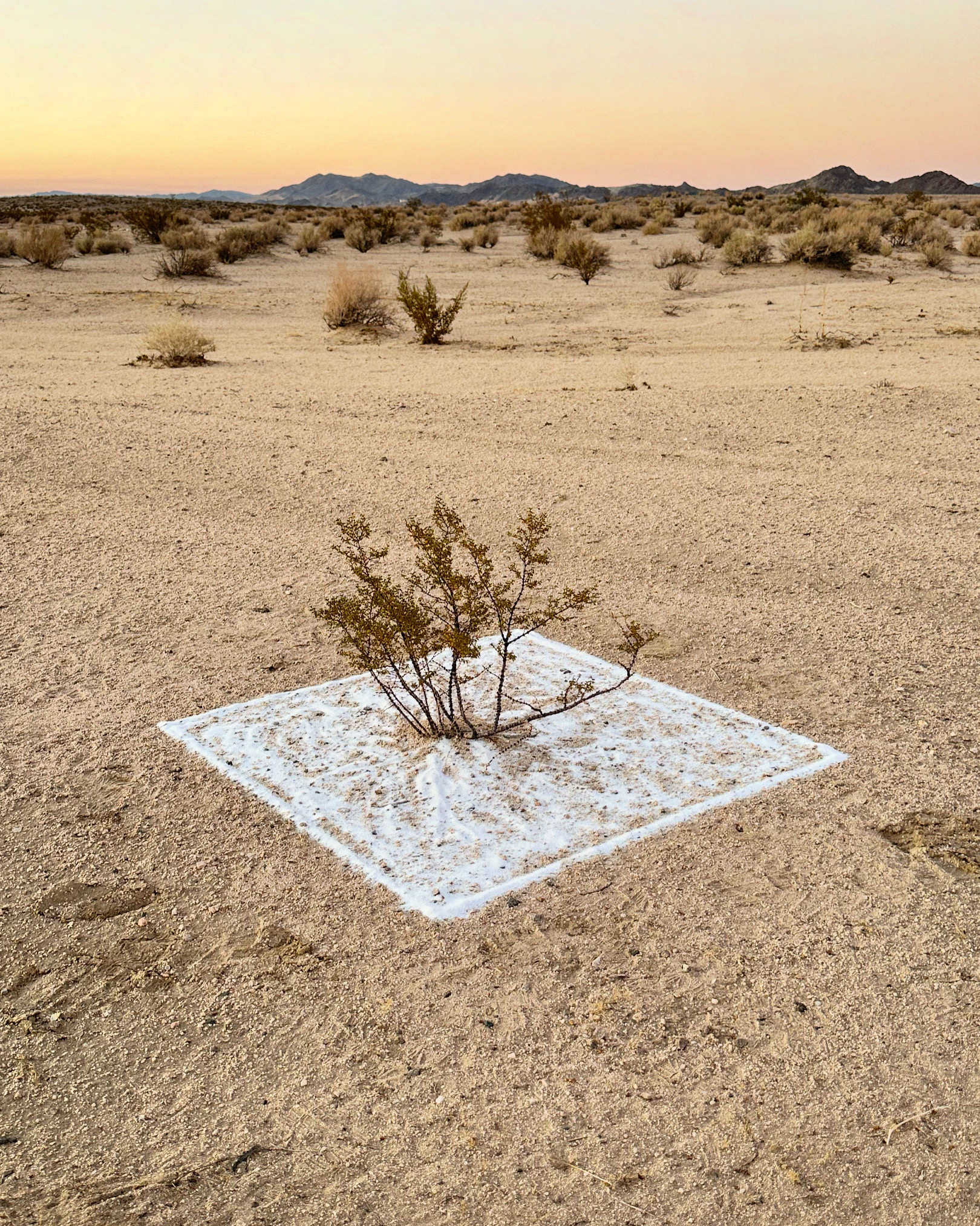
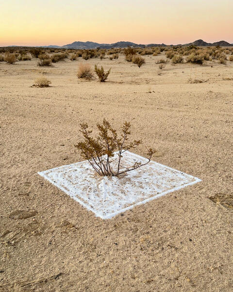 Square Meter: Calcite
Creosote plants dot the horizon of the desert and can capture carbon out of the atmosphere and store it underground with roots sometimes as deep as 40 feet below the sandy surface. For every gallon of oil burned, a square meter of mature forest is needed to counterbalance that carbon released. Calcite sand is lighter in color and when placed around the base of a plant, can reflect heat and cool the roots of the plant in the desert landscape. The wind will erase this temporary measured notation reinforcing the ephemeral nature of our natural world and our relationship with such complex systems.
-
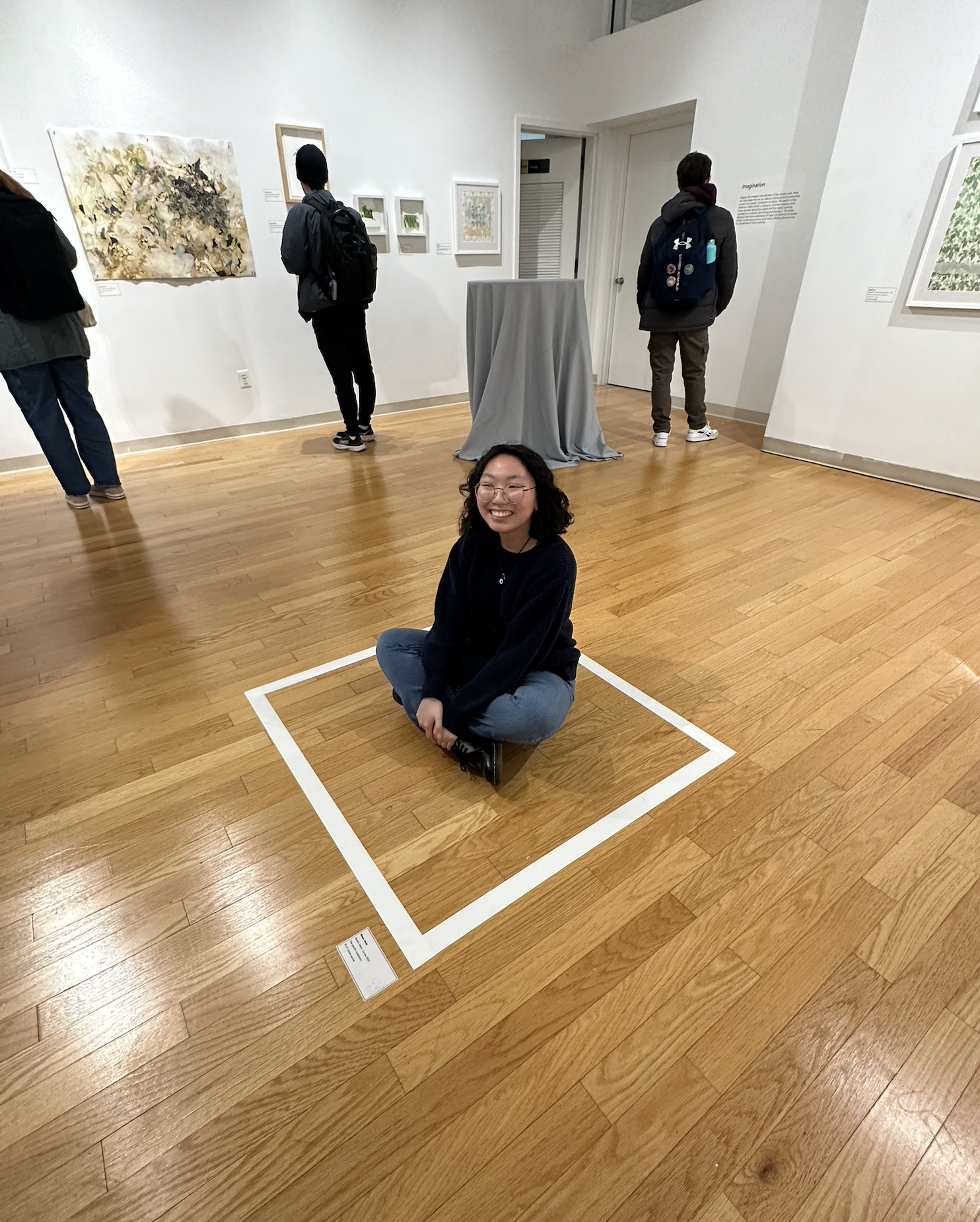
 Square Meter
This photo shows a taped square meter in the gallery that visitors are welcome to stand and sit inside. Giving them opportunity to understand the size of a square meter relative to themselves. The space that one human occupies in relation to the global system of carbon sequestration.
-
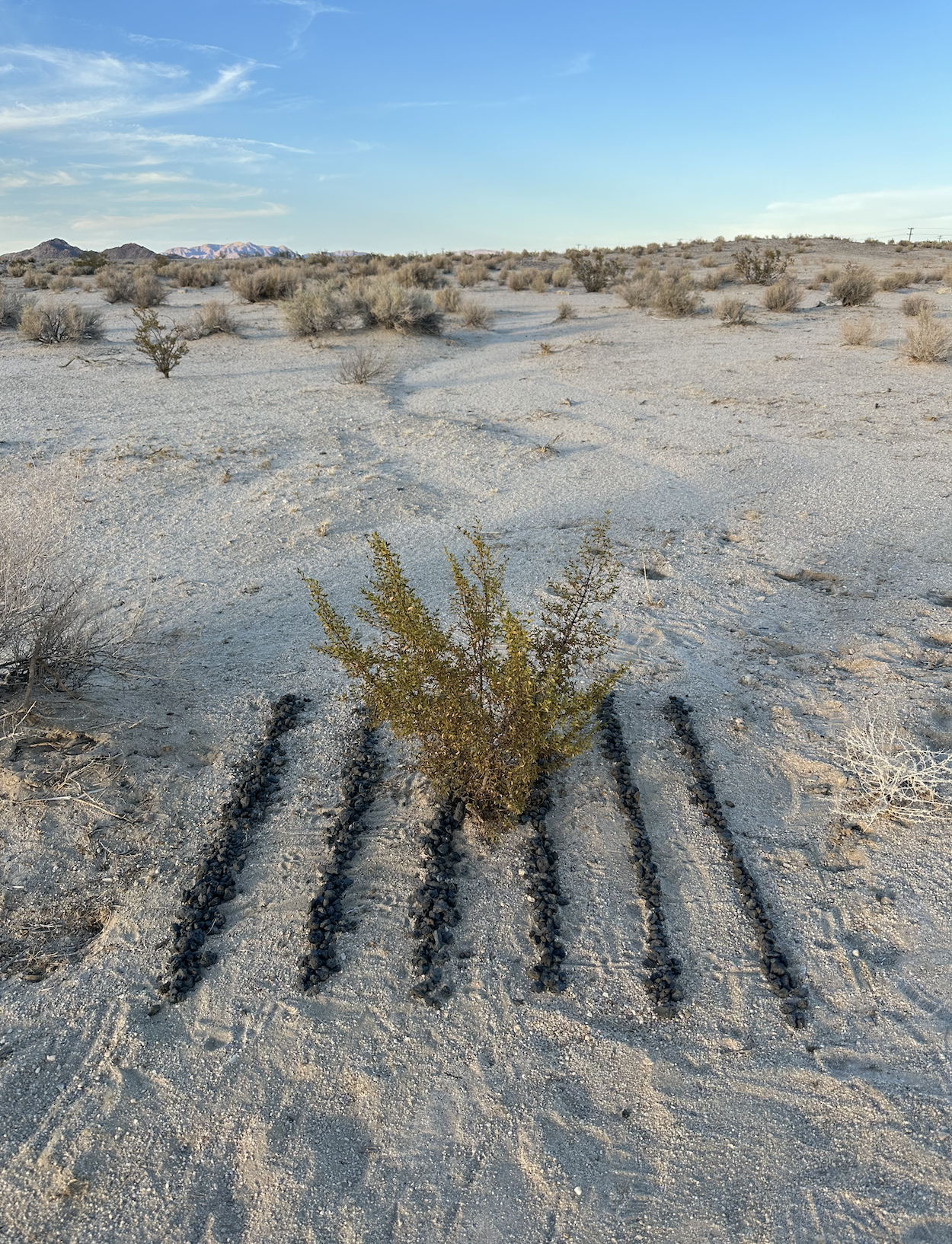
 Square Meter Basalt Rows
Basalt Rock is currently being used as an experimental way to sequester carbon from the atmosphere in rows like planted crops.


Arctic Amplification
-
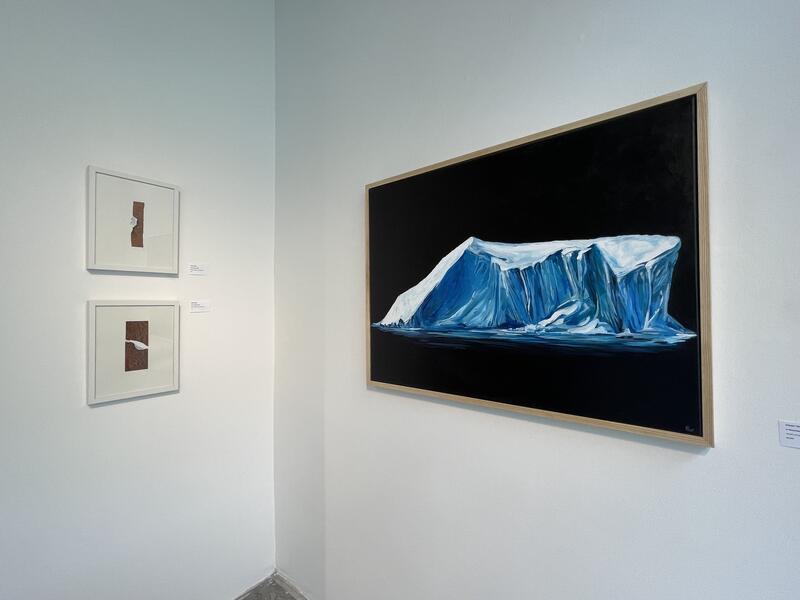 In Memoriam
This painting of a Glacier against a black background creates a memorial like feeling for ice that is disappearing. Soon these stately Ice sheets will be gone and we will be left with the memory of the beauty and urgency of today.
-
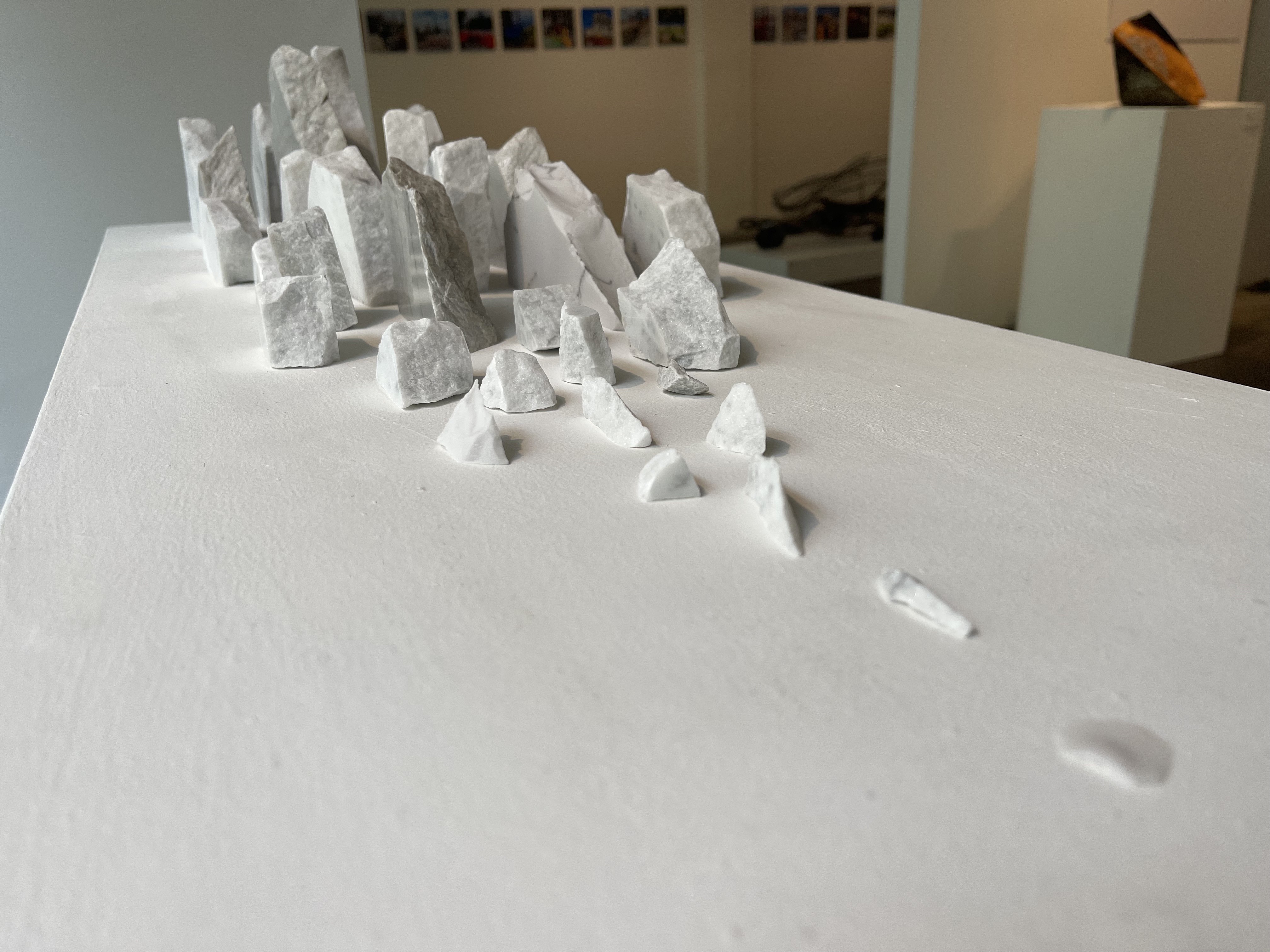
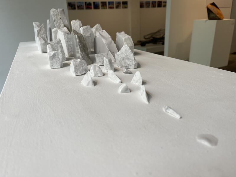 Melting Ice
These berg shaped marble and quartz sculptural pieces are positioned into a melting arrangement that feels playful in scale. Bringing these larger complex global changes into hand held notations in the gallery.
-
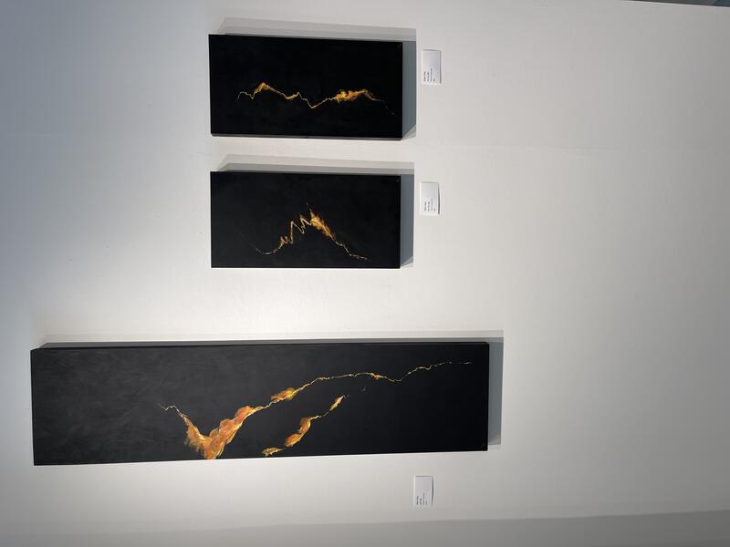 Arctic Amplification Firelines
These paintings of imagined fire lines are similar to the view point of wild fires from above as flames engulf the surrounding dark forests. These paintings sit opposite the melting ice paintings and sculpture to illustrate the teleconnection between melting ice, changing jet stream patterns and increased dry periods and fire threats on the west coast. While living in Washington State, I was very aware of the dangers of the prolonged dry seasons as fire risks elevated and neighborhoods threatened.
-
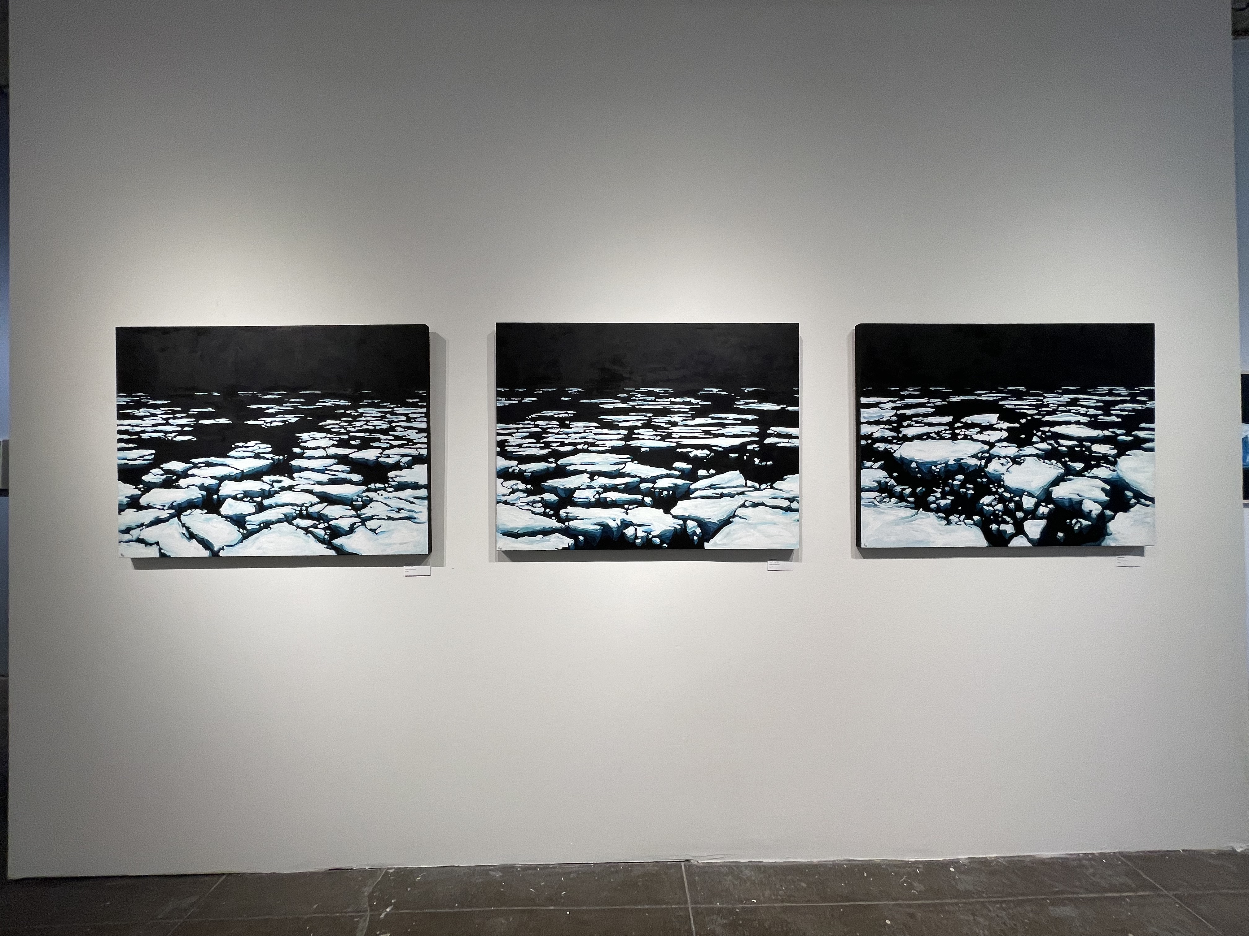
 Bergy Bits
These paintings depict an expanse of melting ice that seems to go on into an endless dark horizon. The instability one feels with the lack of solid grounding in these images, is similar to the precarious situation we find ourselves in with climate change. Alaska locals call these broken pieces of ice in the water "bergy bits" as they break apart and float into the water.
-
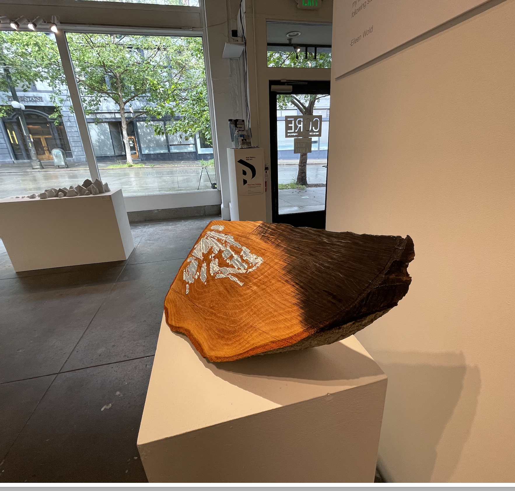
 Alder Wedge
Alder trees are often the regrowth that follows a forest fire in the PNW. After using silver leaf on one side to notate ice melt, I burned the other half of the wedge to represent the fires that are burning. Together in one chunk of alder tree, the teleconnections between Arctic ice and forest fires are shown.
-
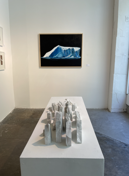 Installation shot of Arctic Amplification
This gallery view of the Arctic Amplification exhibit shows the marble glacier sculptures playfully melting into the horizon of the memorial painting.


Jet Stream Slab
-
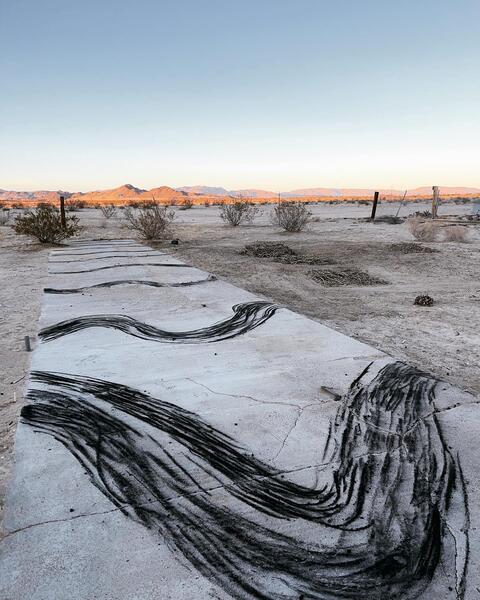
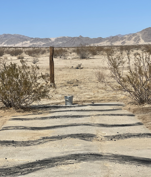
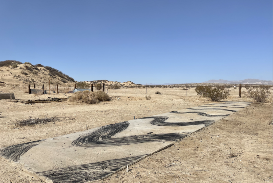
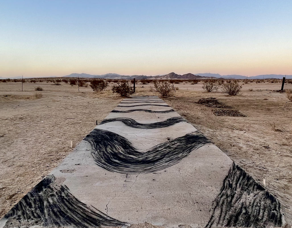
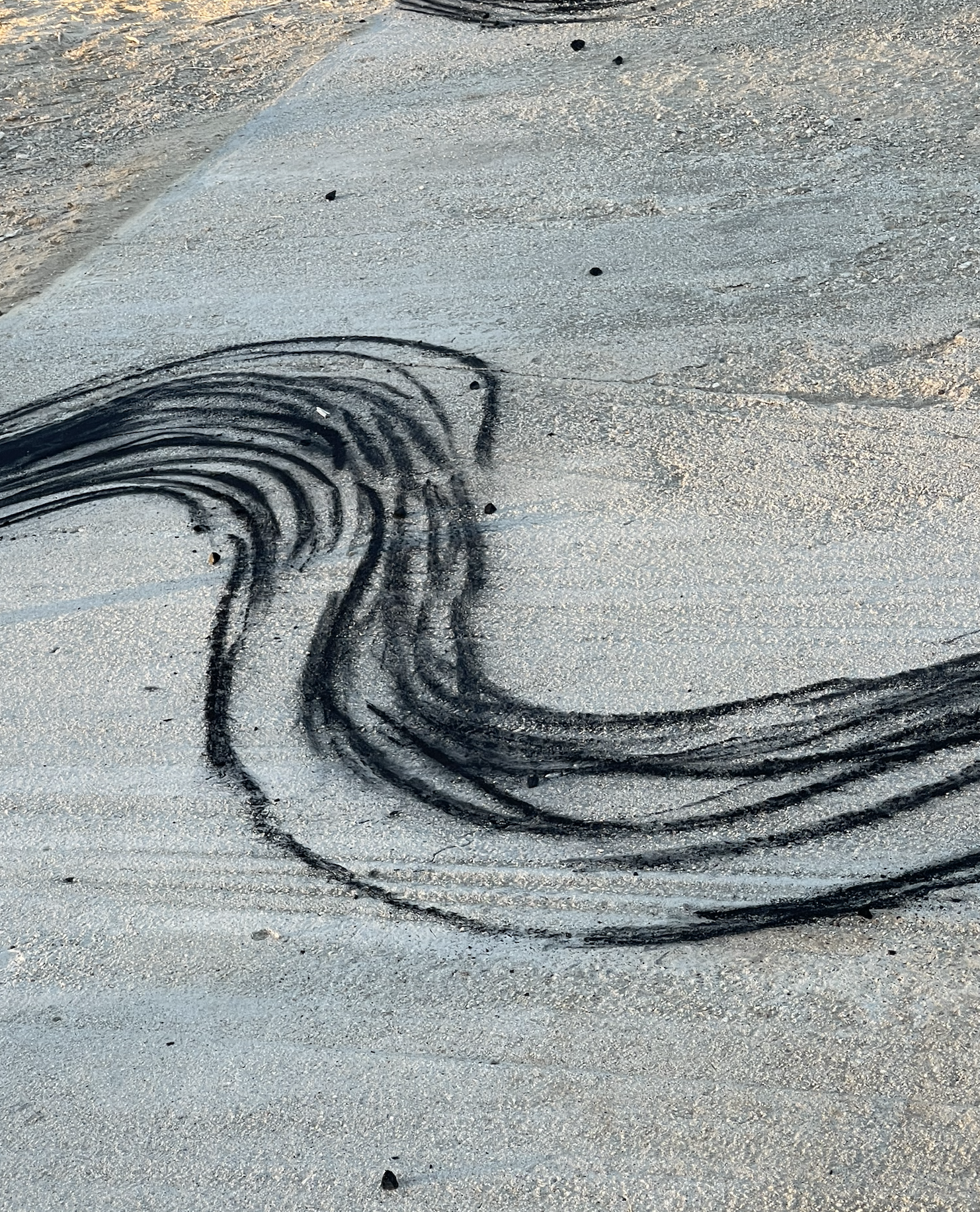
 Jet Stream Slab
This image shows the charcoal drawing I created on an old concrete slab in the desert of California. I used collected mesquite tree branches to burn and make charcoal each morning to draw with over the course of two weeks. The drawing shows the changing jet stream pattern due to Arctic ice melt over time. These increased variations in the jet streams are creating stalled extreme weather systems that will increase over time. The shifting winds each evening would erase part of the mark making from the day before allowing me to shift the drawing over time to reflect the changes in the jet streams overhead.
-
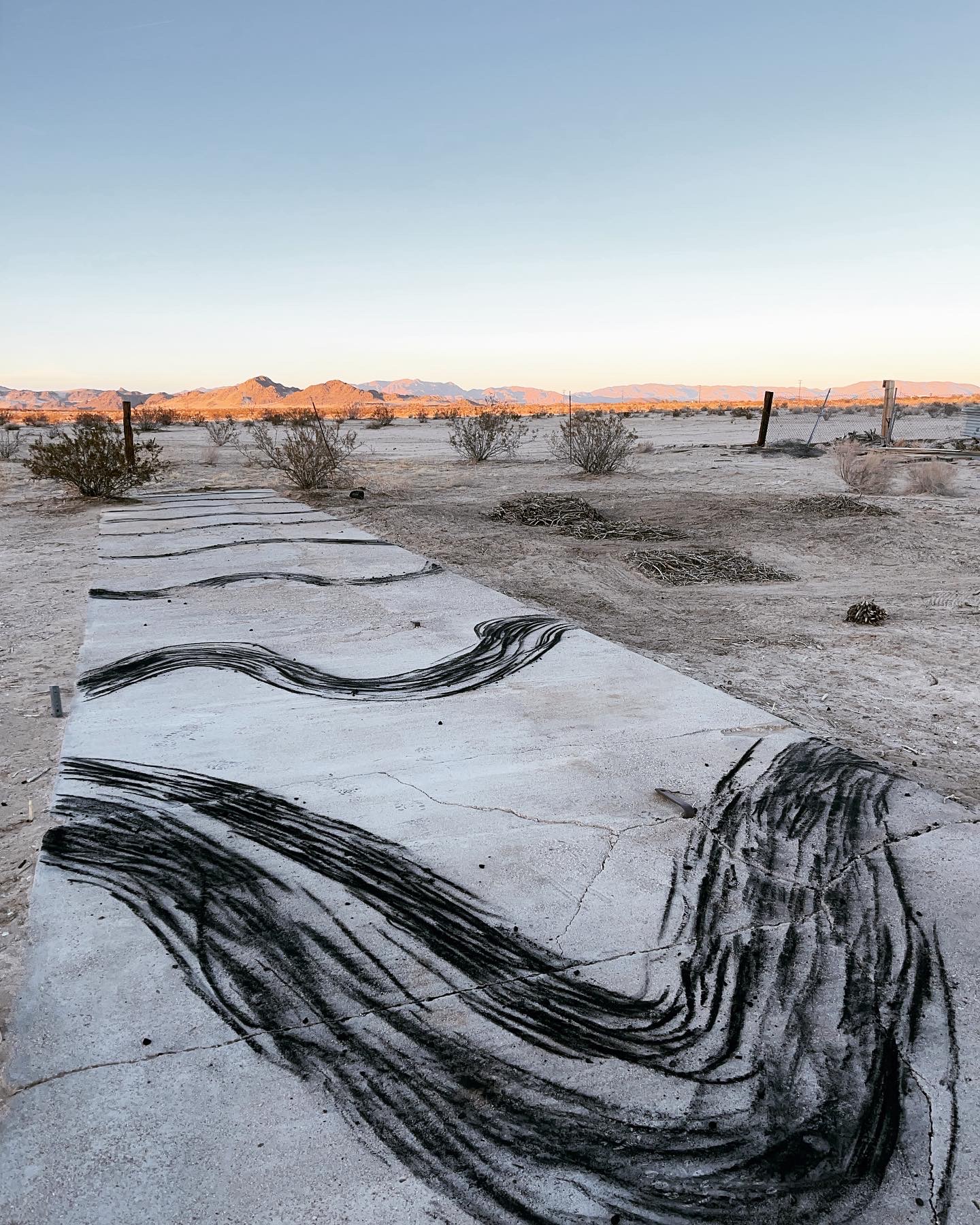
 Jet Stream Slab Calm
The Jet Stream slab drawing would change over time becoming more dramatic in the wave pattern as time went on.
-
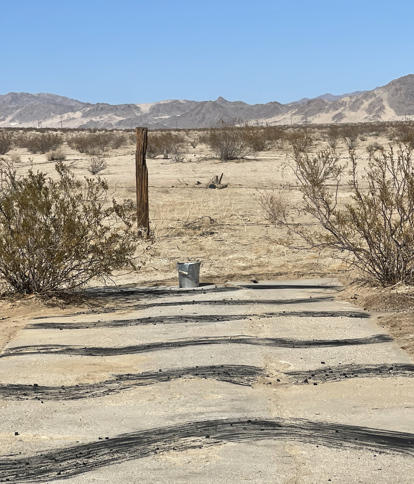
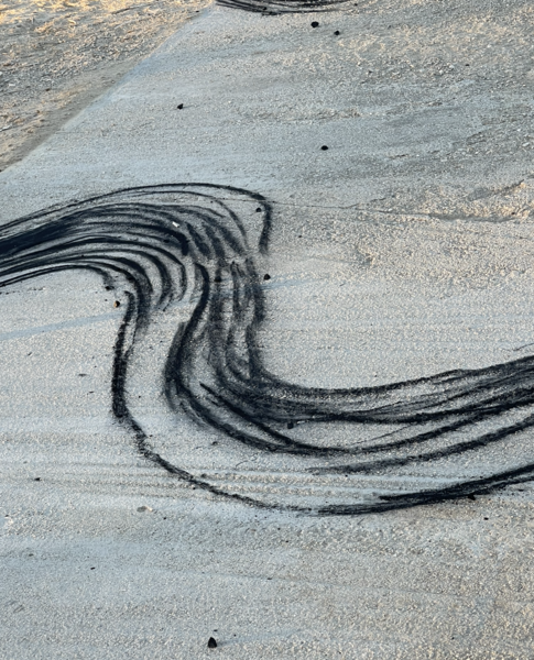 Jet Stream Slab detail
Detail view of the charcoal drawing of Arctic Jet Stream patterns on concrete slab.
-
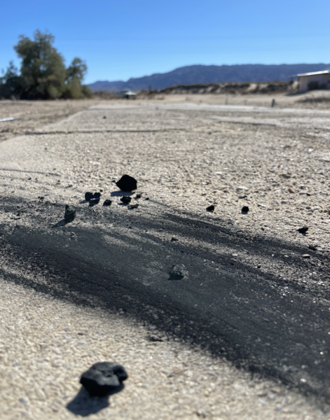 Detail of charcoal drawing
Detail photograph of the charcoal I created and used to make the Jet Stream Slab drawing in California
-
 Jet Stream Slab view
The patterns of the Arctic Jet stream are becoming more extreme as the Arctic Ice melts and changes the temperatures across the PNW.


Fuel Cubes
-
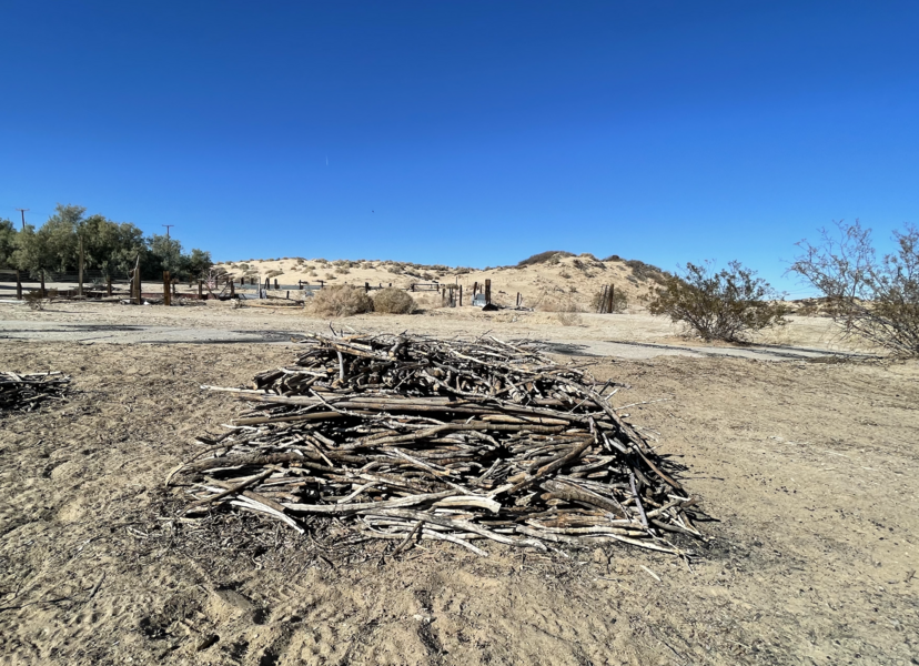
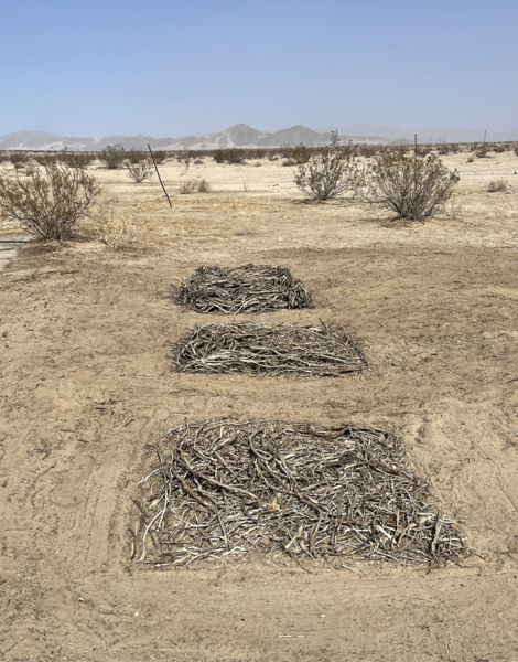
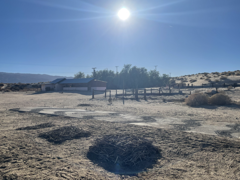
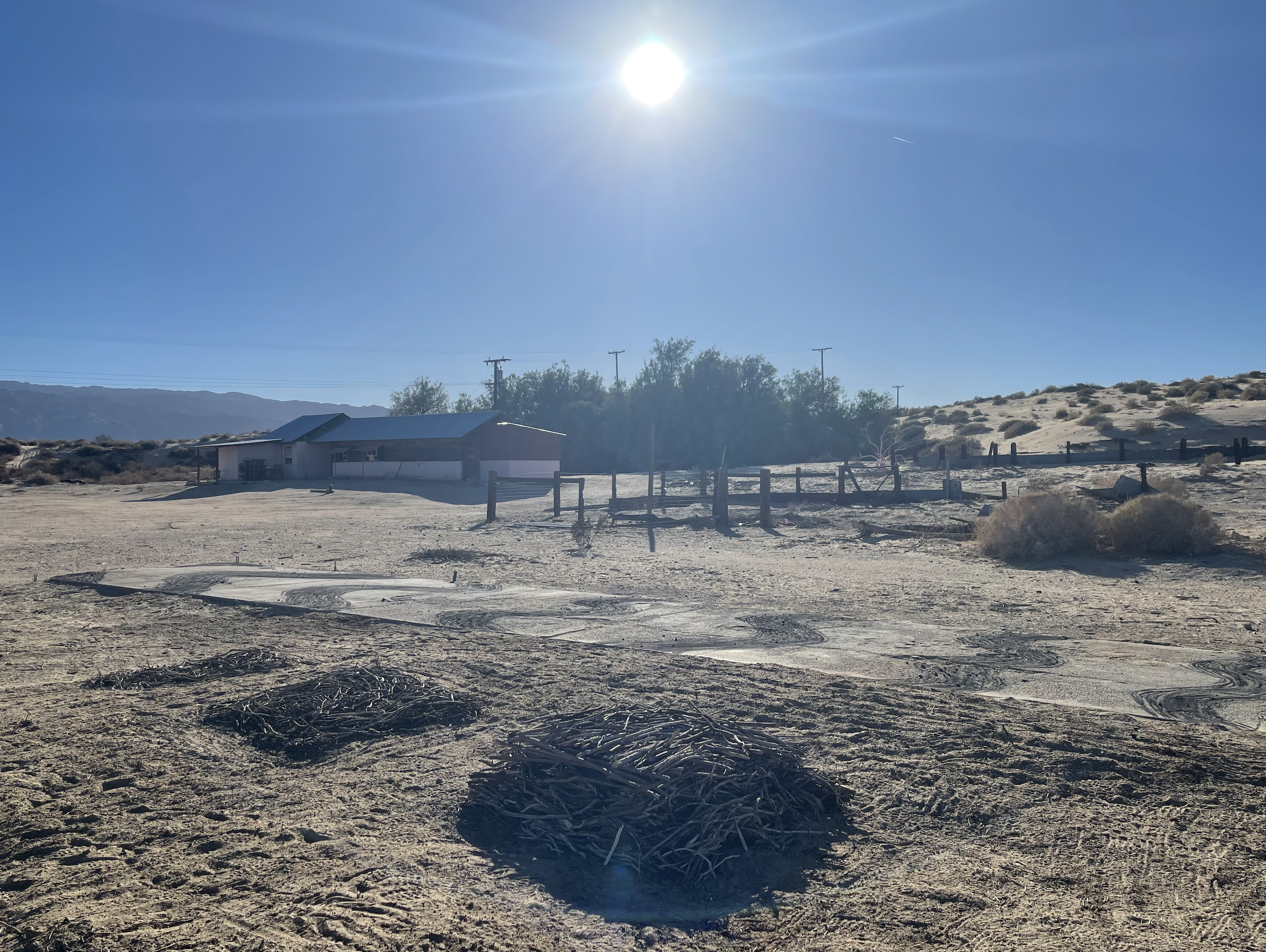
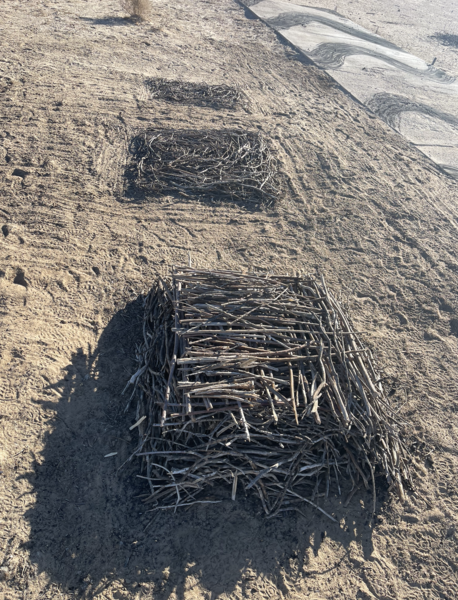 Fuel Cubes
Collected sticks from within the landscape are gathered into geometric forms, organized into piles of increasing height. Our instinct to create order and hierarchy in nature is reflected in this site specific project at the Desert Dairy residency in 29 Palms, California. A drawing in the landscape that explores wood an original source of power and energy for human development as well as a threatening kindling for wildfires of the west coast region.
-
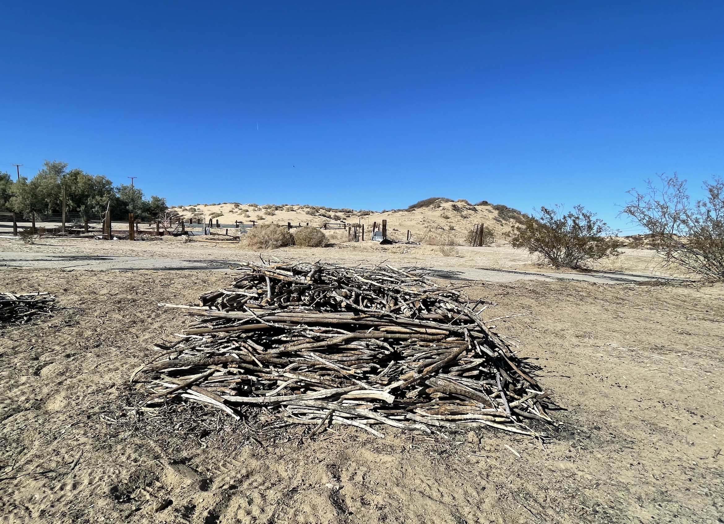
 Fuel Cube
Collected sticks from within the landscape are gathered into geometric forms, organized into piles of increasing height. Our instinct to create order and hierarchy in nature is reflected in this site specific project at the Desert Dairy residency in 29 Palms, California. A drawing in the landscape that explores wood an original source of power and energy for human development as well as a threatening kindling for wildfires of the west coast region.
-
 Fuel Cubes
Collected sticks from within the landscape are gathered into geometric forms, organized into piles of increasing height. Our instinct to create order and hierarchy in nature is reflected in this site specific project at the Desert Dairy residency in 29 Palms, California. A drawing in the landscape that explores wood an original source of power and energy for human development as well as a threatening kindling for wildfires of the west coast region.
-
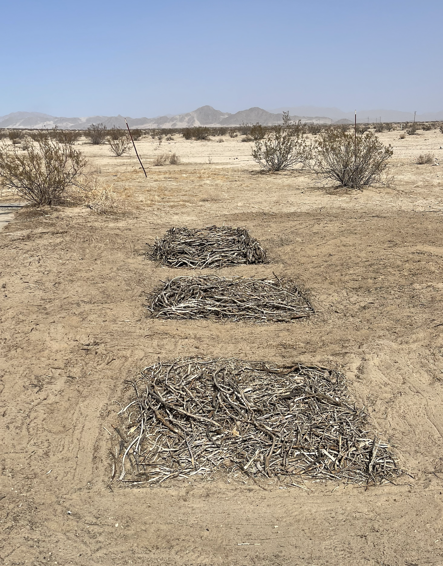
 Fuel Cube Landscape
These sticks were gathered from around the landscape, organized and piled into cubes.

Baltimore: Empty Waters
-
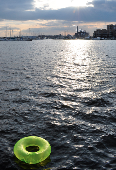
 Empty Waters: Inner Harbor
This series shows playful swimming tubes in the Baltimore harbor. A place where swimming is not possible but our relationship with water is one of recreation, food harvesting, and visual respite. This conflict of our instincts for what it should be and the reality of what it is, is explored in this series of drawings and photographs.
-
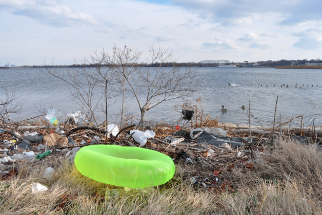
 Empty Waters Harbor Hospital Shoreline
This series shows playful swimming tubes in the Baltimore harbor. A place where swimming is not possible but our relationship with water is one of recreation, food harvesting, and visual respite. This conflict of our instincts for what it should be and the reality of what it is, is explored in this series of drawings and photographs. This photo was taken along the shore behind harbor hospital.
-
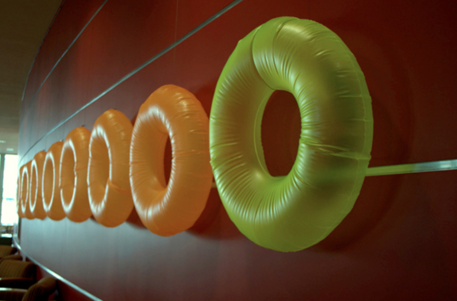 Inner Tube Installation: University of Maryland
The Inner tubes from the University of Maryland Empty Waters Series were hung opposite the drawings and photographs.
-
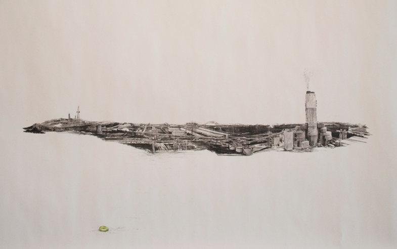
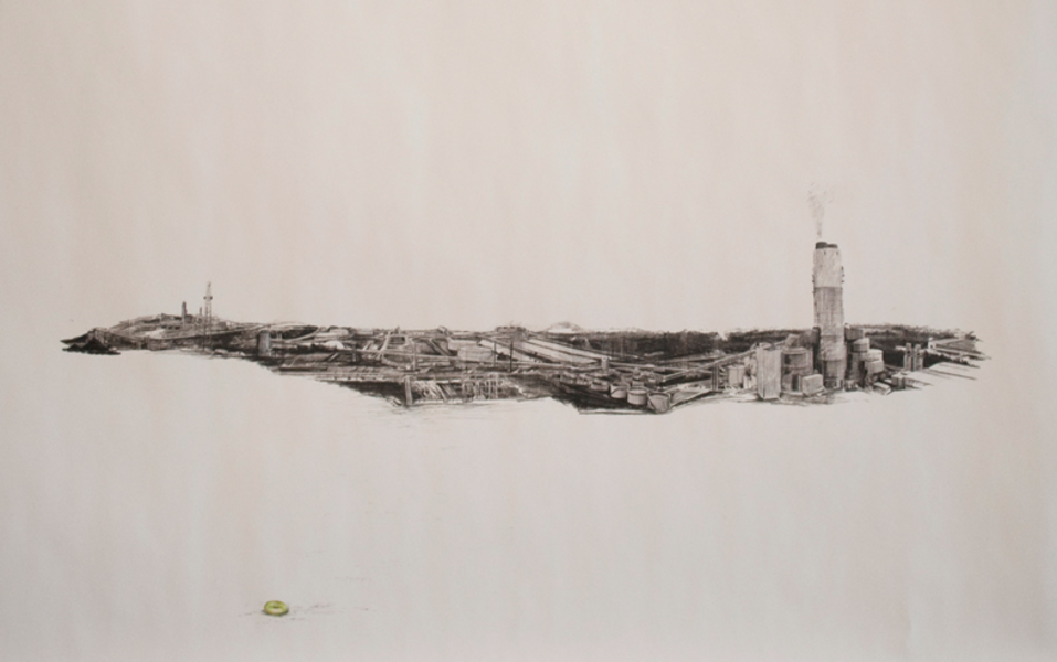 Empty Waters: Lanscape of Energy
These drawings of inner tubes among energy infrastructure reminds us of our human impact on our natural environment and how often our wants are at odds with our needs.
-
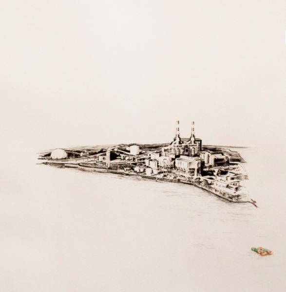 Empty Waters Coal Plant
These drawings of inner tubes among energy infrastructure reminds us of our human impact on our natural environment and how often our wants are at odds with our needs.
-
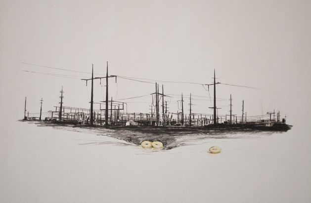
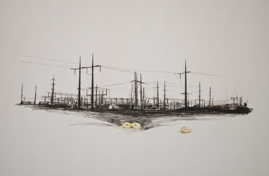 Empty Waters Power Lines
These drawings of inner tubes among energy infrastructure reminds us of our human impact on our natural environment and how often our wants are at odds with our needs.
-
Empty Waters


Energy Studies
-
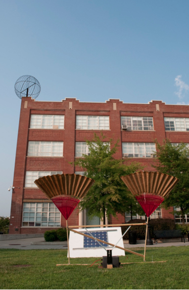
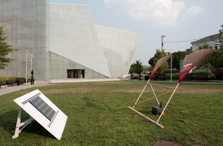
 Fan Bearer
This sculpture was created with two rakes converted into fans, hooked up to a solar panel and windshield wiper battery that moved the fans slowly up and down to fan visitors. With modern technology and energy power, we can now all benefit from being cooled in a way that was only available to the very rich or important when we relied on man power alone.
-
 Fan Bearer installation
This sculpture was created with two rakes converted into fans, hooked up to a solar panel and windshield wiper battery that moved the fans slowly up and down to fan visitors. With modern technology and energy power, we can now all benefit from being cooled in a way that was only available to kings when we relied on man power alone.
-
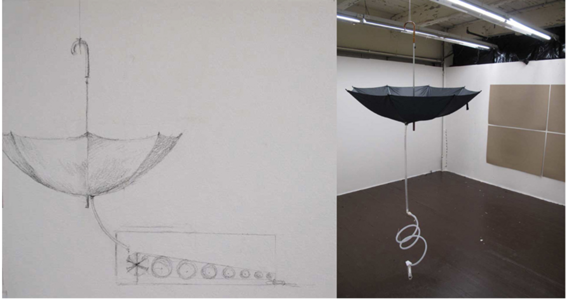 Umbrella Water Wheel
This drawing came after a conversation I had with an engineer who said "if you can get wheels to spin, we can make energy" so I took to the studio creating funny ways wheels could spin. This playful drawing of an upside down umbrella attached to a tube and series of wheels was recreated in my studio with found objects.
-
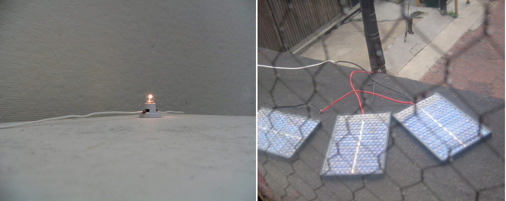
 Credit Card Solar Panels
These small credit card sized solar panels were attached to 25 and 50 feet of wire where they lit a small bulb with a direct current in a windowless room. If the bulb was lit you knew it was light outside.
-
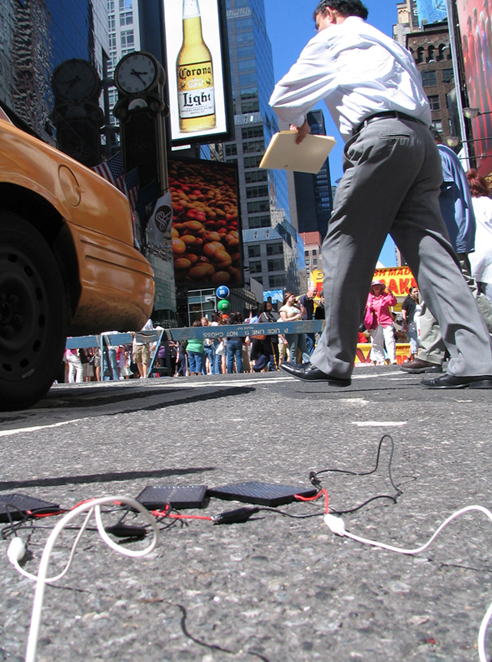
 Credit Card Solar Panels NYC
These credit card size solar panels were connected to a small bulb and placed in the center of NYC . The juxtaposition of the giant commerce center and electric consumption against the humble system I created was to show a sense of scale, time, and humor.
-
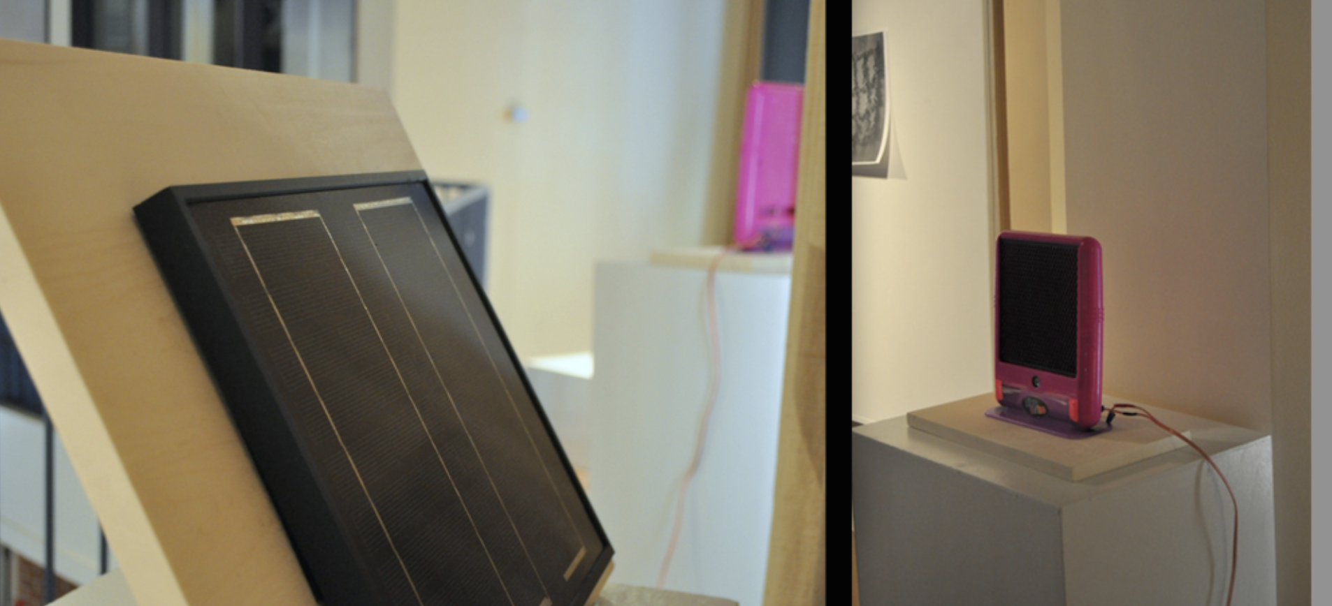
 Solar Paneled Lite-Brite
This gallery view of a solar panel live wired to my child's toy is a comment on the many ways in which we rely on electrical power and the playfulness of invention.

West Virginia Coal
-
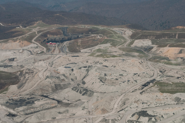
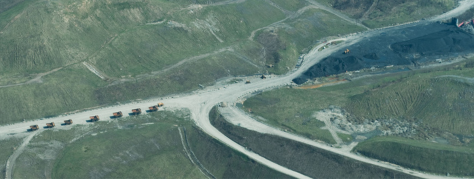
 Surface Mines West Virginia
This series is a documentation of a six month investigation into the origins of the coal supply at the Baltimore coal terminal and the coal that was burned at a Baltimore power plant.
Traveling down to the southern mountain ranges of West Virginia, I documented the surface of coal mines from the air and on the ground. From interviews with coal miners and industry professionals, to chartering a flight over active mines, I investigated the extraction of coal from various perspectives through drawing, photography, and video.
-
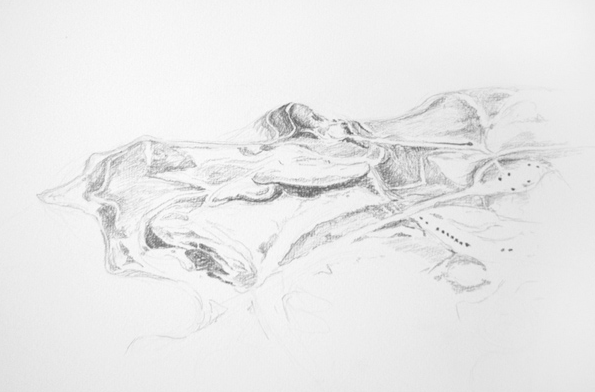
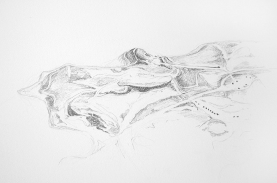 Surface Mines Pencil drawing
Pencil Drawing of surface coal mines in West Virginia
-
 Surface Mine Road Extraction
This series is a documentation of a six month investigation into the origins of the coal supply at the Baltimore coal terminal and the coal that was burned at a Baltimore power plant.
Traveling down to the southern mountain ranges of West Virginia, I documented the surface of coal mines from the air and on the ground. From interviews with coal miners and industry professionals, to chartering a flight over active mines, I investigated the extraction of coal from various perspectives through drawing, photography, and video.
-
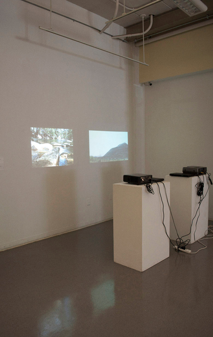
 Videos installation of Coal Wash and Stream with Mercury
The the mechanisms of video work clearly in view, viewers could watch two videos simultaneously in the gallery. One video showed the constant watering of coal piles in Baltimore city to keep the dust from neighboring streets where I lived at the time. And the other video was a stream in West Virginia that was full of Mercury down stream from a coal washing station.
-
 Baltimore Landscape of Energy
This series is a documentation of a six month investigation into the origins of the coal supply at the Baltimore coal terminal and the coal that was burned at a Baltimore power plant.
Traveling down to the southern mountain ranges of West Virginia, I documented the surface of coal mines from the air and on the ground. From interviews with coal miners and industry professionals, to chartering a flight over active mines, I investigated the extraction of coal from various perspectives through drawing, photography, and video. -
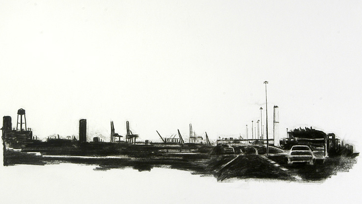
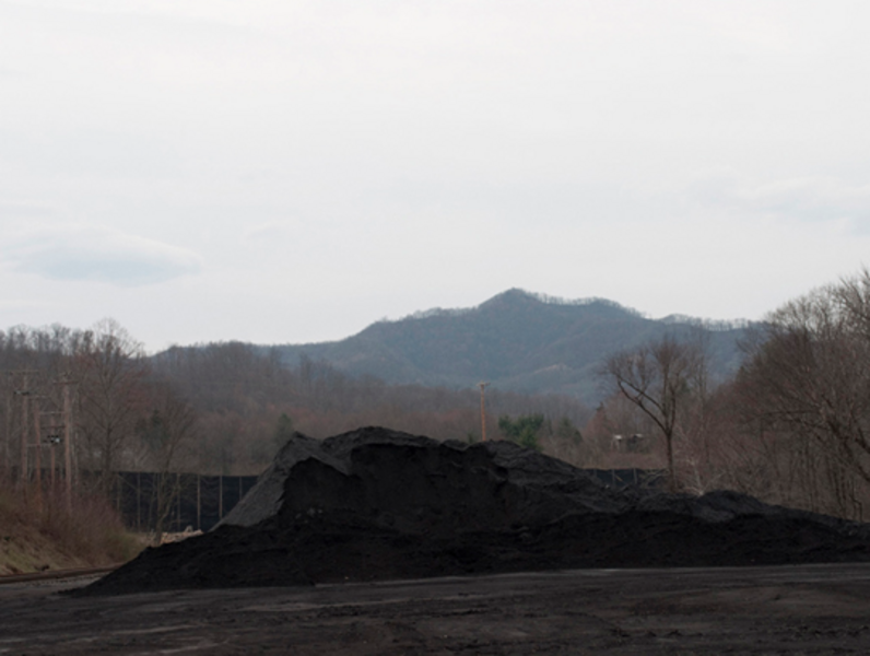 Coal Mountain
This photo shows a pile of coal in West Virginia ready to be loaded by train to Baltimore as well as the last mountain in the area that had not been mined.